The phrase "the
Antarctica" generally means the continent of Antarctica, together with its
surrounding ice shelves, islands, and seas. In geopolitical
terms, the Antarctica encompasses the whole area south of 60th parallel,
which is the area to which the Antarctica Treaty applies. Antarctica
is the 5th largest continent with an area of roughly 14 million square
kilometers (larger than Europe and Australia), Most of this area is made up
by a vast permanent ice sheet averaging 2,450 meters (8,000 feet) in
thickness. Antarctica, on average, is the coldest (the lowest outdoor
temperature ever recorded is -89.2°
C), driest (mean annual accumulation is 15cm of water equivalent, which is
just slightly more than Sahara Desert), and windiest continent (average wind
speed of 72kph (45 mph) with gusts of more than 240kph was recorded in
Commonwealth Bay), and has the highest average elevation (average is 2,500
meters (8,200 feet)) of all the continents.
Getting there ...
Antarctica has been on my wish list for a long
time. However, the notorious Drake Passage (~800 km
wide of water passage between South America's Cape Horn and
the South Shetland Islands of Antarctica) has been a major
blocker
for Woanyu since she was worry about the sea sickness. Until
about 1.5 years ago I found there was an option to fly over the
Drake Passage, and finally I could convince Woanyu to go on an
Antarctica trip. We booked the "Fly-the-Drake"
from Quark Expedition,
which will provide a charter plane to fly between Punta Arenas
(Chile) and King George Island (Antarctica). It does not only
avoid the rough sea at the Drake Passage, but also saves us ~ 4 days
of cruise time (it's about 2.5 hours of flight vs. ~ 2 days of
cruise one way).
In addition to Antarctica, my another
dream destination, Patagonia, is
also in a nearby region in southern Chile. It was a natural
choice for me to combine two amazing places into one trip just like
two dreams come true together. Our overall itineray looks like
this: 2 nights in Santiago, 1 night in Punta Arenas, 4 nights
in Antarctica cruise, 2 nights back in
Punta Arenas, and 4 nights in Patagonia. |
 |
Day 2 (Feb 2) ...
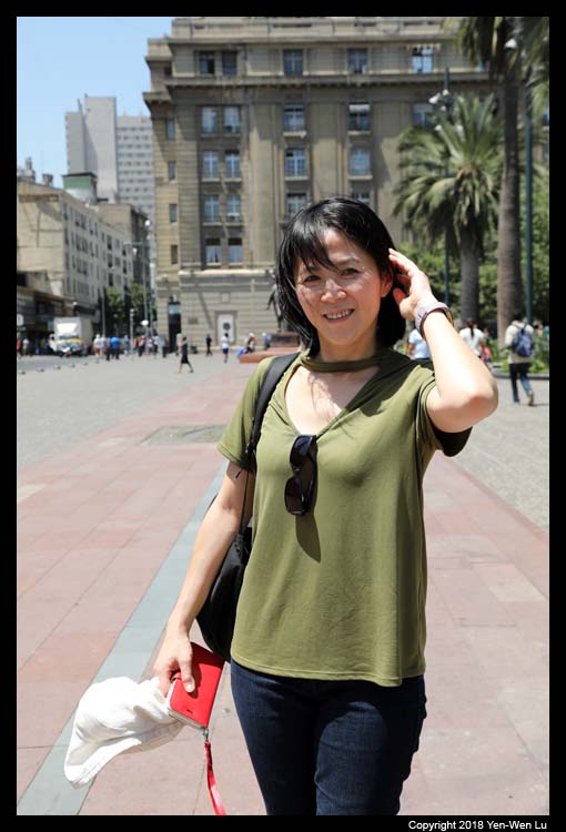
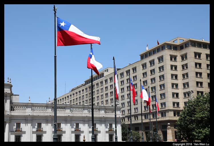
- Santiago de Chile
We arrived in Santiago in the morning as our first stop to visit South
America (in fact, this was our first time in South America). I
booked a private tour (from
Cultura Cercana) for a half-day Santiago city tour and also a Valparaiso/Vina del Mar/wine
tasting tour on the next day. We were picked up by our guide
Fernando from the airport and headed toward the city center directly
(after a long wait in the airport immigration line...).
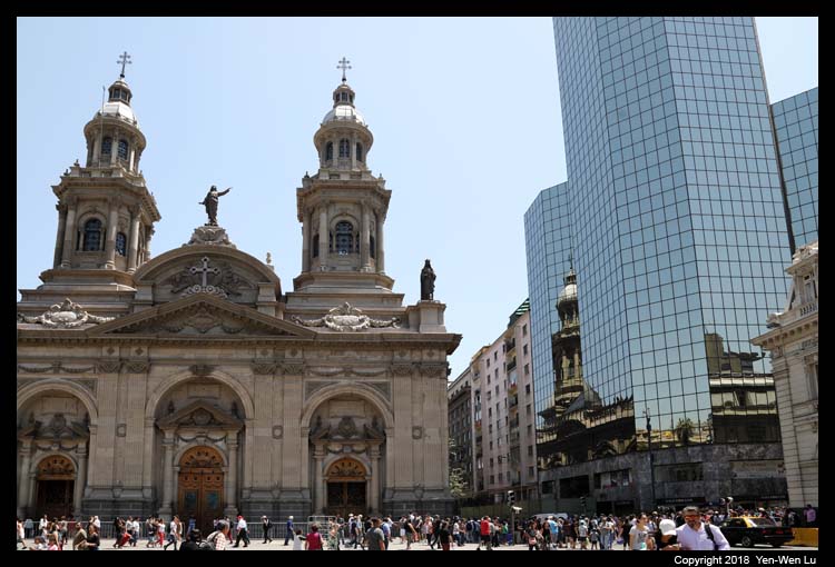
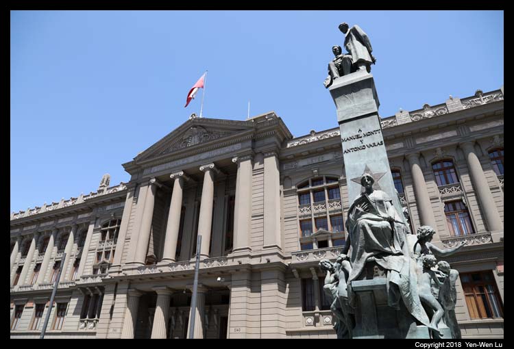
Founded
in 1541 by the Spanish conquistador Pedro de Valdivia, Santiago de Chile
(or simply Santiago) has been the capital city of Chile since colonial
times. It is also the largest city in Chile with a downtown core of
19th-century neoclassical architecture and winding side-streets, dotted by
art deco, neo-gothic, and other styles. It is a Mediterranean
climate with a warm dry summer, which is quite similar to our home in
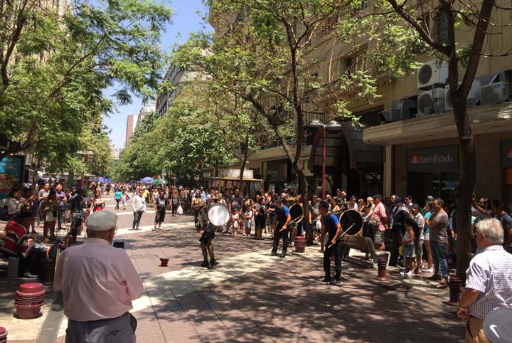
California Bay Area. The vibrant streets with a lot of outdoor
activities and street shows reminded us it was summer here now!
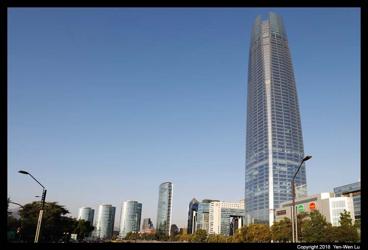
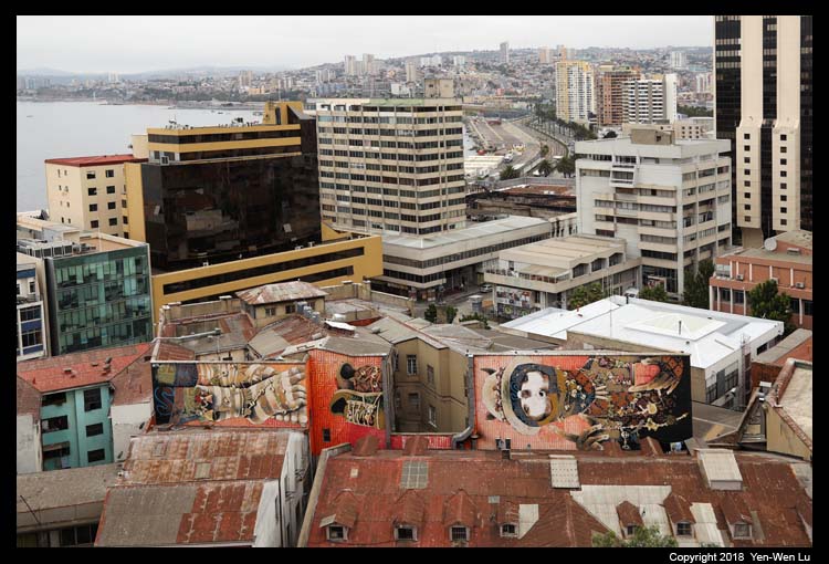
After we checked in the hotel and had a nice dinner
in a nearby restaurant, we walked to the Costanera Center and went up to the
Observatory (Sky Costanera)
at the 61st floor. At a height of 300 meters, Sky Costanera has the
most impressive 360° view of Santiago. The tower was complete in 2013
and is tallest building in the Latin America.
Day 3 (Feb 3) ...
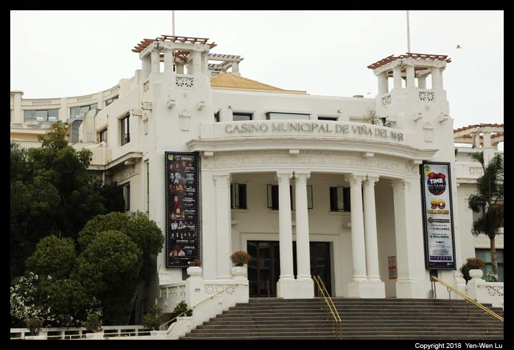
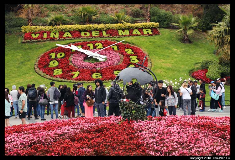
- Viña del Mar
Viña del Mar is known for its placid resorts, malls,
extensive coastal high buildings, hotels and various entertainment
venues (e.g., Casinos). We stopped by a few tourist spots
but did
not stay long since our guide would like to show us more in Valparaíso.
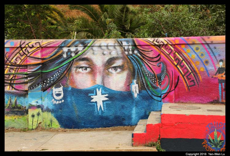
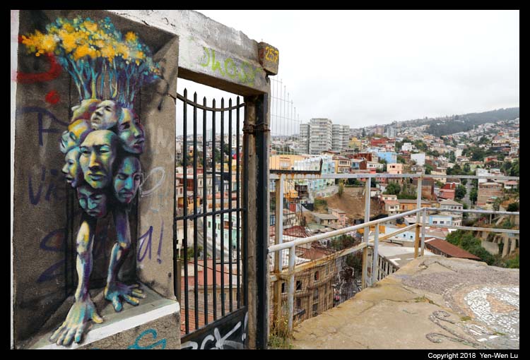
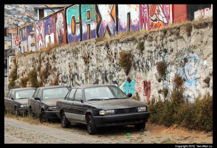
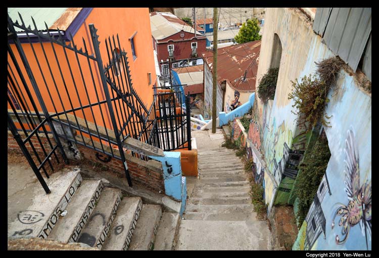
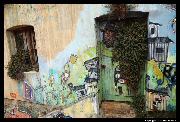
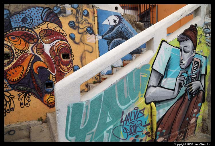
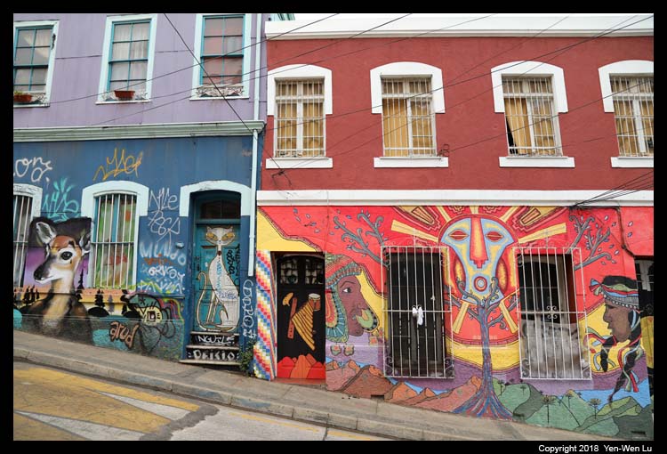
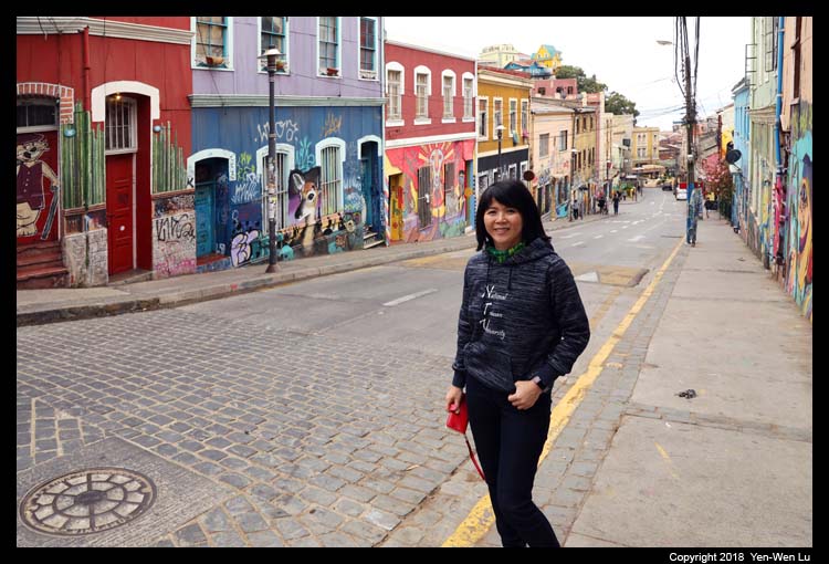
- Valparaíso
Just 120km (75 miles) from Santiago lays Valparaiso
“Cultural Heritage of the Humanity” and Chile´s main port, and it is
also the seat of the National Congress. Valparaíso played an
important geopolitical role in the second half of the 19th century, when
the city served as a major stopover for ships traveling between
the Atlantic and Pacific oceans by crossing the Straits of Magellan.
However, the second half of the twentieth century was unfavorable to
Valparaíso. The opening of the Panama Canal and reduction in
ship traffic dealt a serious blow to Valparaíso’s port-based economy.
Over the past 15 years, the city has staged a recovery, attracting
artists and cultural entrepreneurs who have set up in the city's
hillside historic districts. Today, many tourists (ourselves included)
visit Valparaíso from around the world to enjoy the city's labyrinth of
cobbled alleys and colorful walls and buildings.
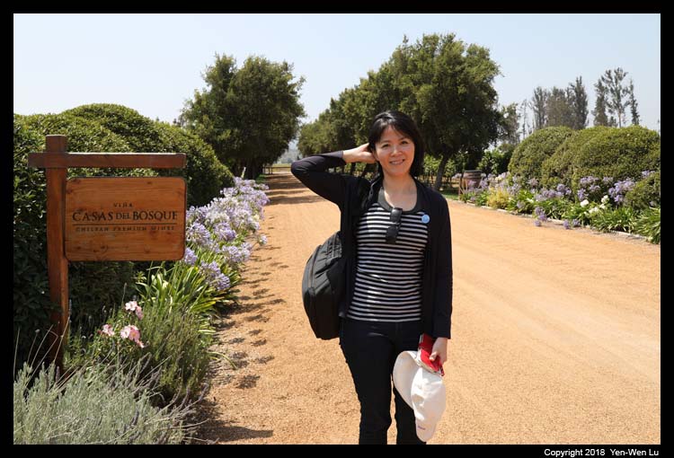
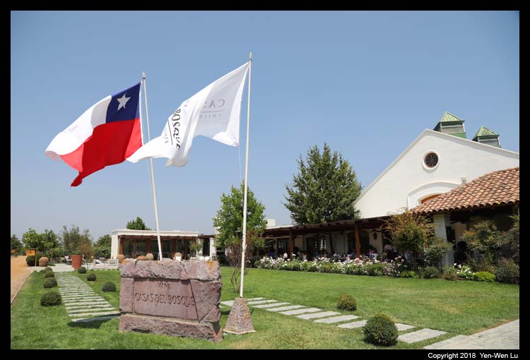
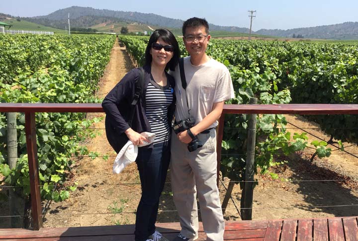
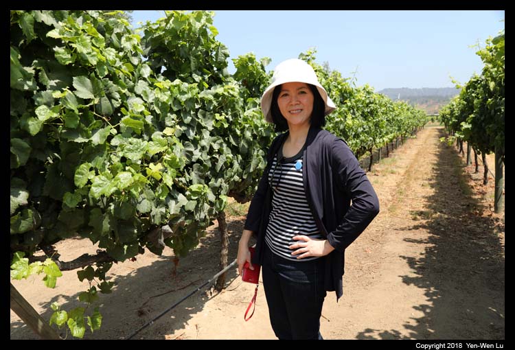
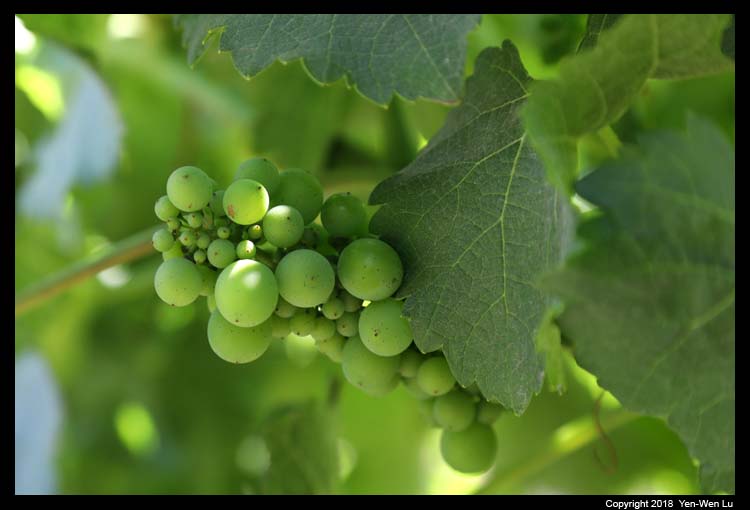
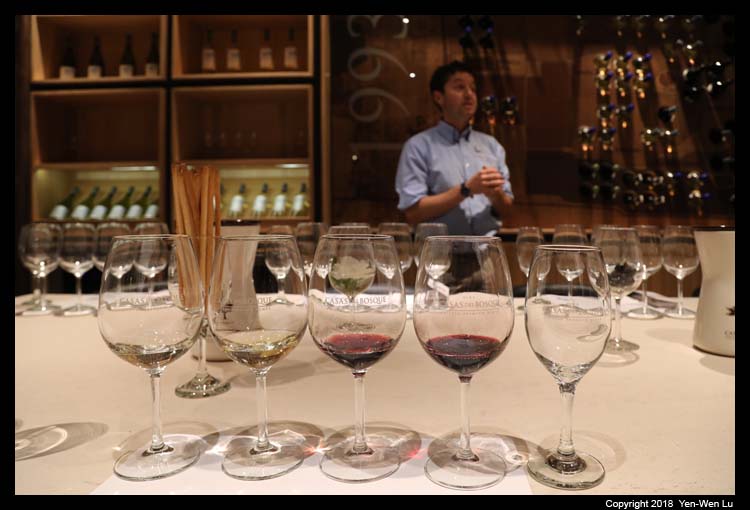
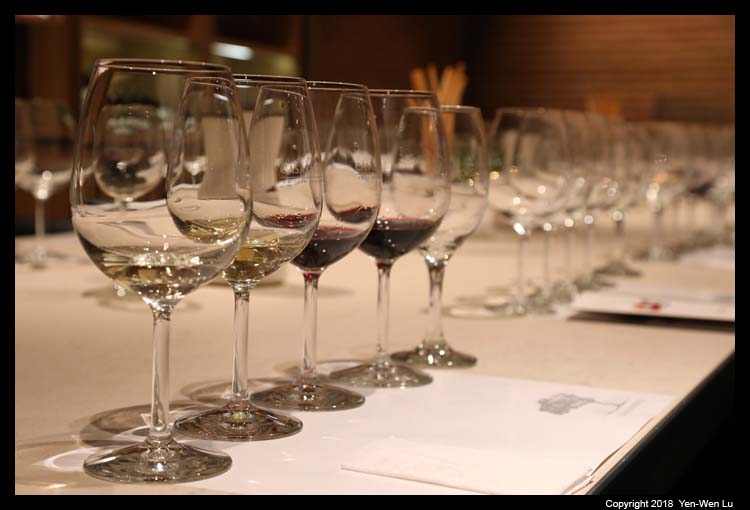
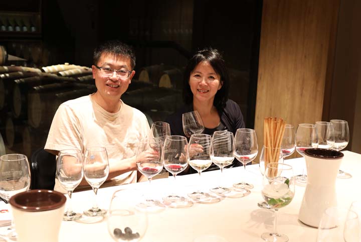
- Vina Casas Del Bosque
Casas del Bosque is located 70 km northwest of Santiago. The Cúneo
family, Italian descendants, founded the vineyard in 1993, in the far
western reaches of the Casablanca Valley, one of the coolest spots in
the area. Vines were first planted in the Casablanca valley in the
mid-1980s during the revitalization of the Chilean wine industry and
quickly became known for its white wines, most notably Sauvignon
Blanc and Chardonnay, as well as Pinot Noir, which thrives in its cooler
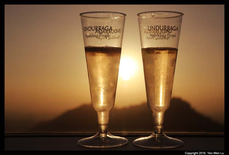
climate. We visited the vineyards and some facilities and wine
cellars, and we were given a premium wine tasting with 6 different wines
(3 white and 3 red wines). We are no experts in any wine, but
those wines do taste good :-)
Day 4 (Feb 4) ...
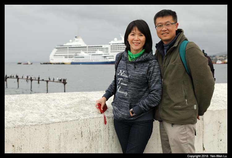
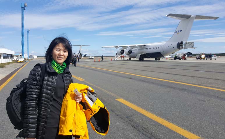
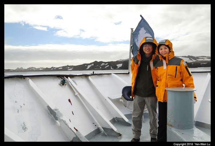
- Punta Arenas
Our Antarctica trip officially started today with an
included charter flight from Santiago to Punta Arenas in the southern
Chile. We checked in at the Santiago Airport at 6AM for the
scheduled 8AM flight, and we arrived in Punta Arenas at about 1PM (but
it was still too early to check in to our hotel room yet...). Although we
had plenty of free time in the afternoon, we were quite busy with all
the preparation work: collecting and fitting our included parka and
loaned boots, organizing our luggage to fit the weight limit (there is a
strict 20 kg limit per person [check-in + carry-on] for the charter
flight to Antarctica, so we had to leave some extra stuffs in the hotel
and will pick them up after we were back from Antarctica), vacuum our outer
layer clothing and bags to avoid contaminating the eco system in
Antarctica, attending the exciting pre-trip
orientation and information session (with interesting slides and videos),
and a nice welcome dinner buffet at the hotel with our travel
companions. We were so busy that we forgot to take pictures during
these activities...
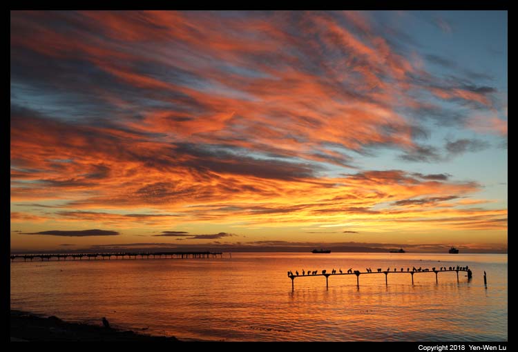
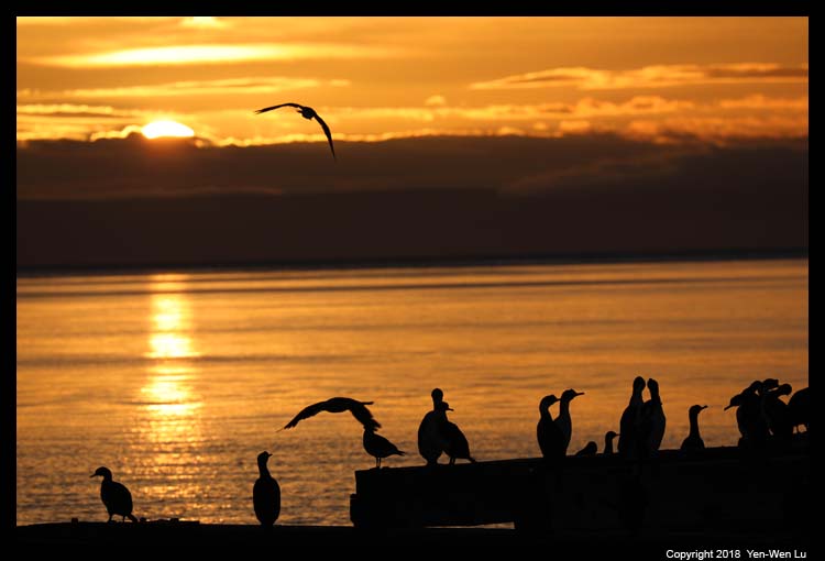
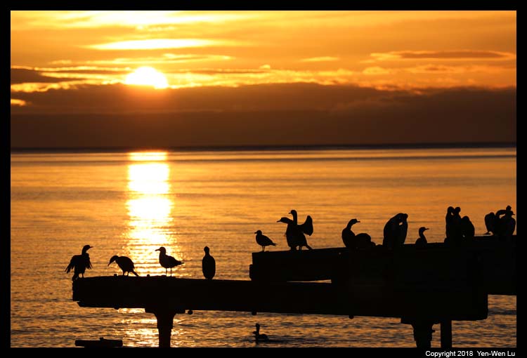
Day 5 (Feb 5) ...
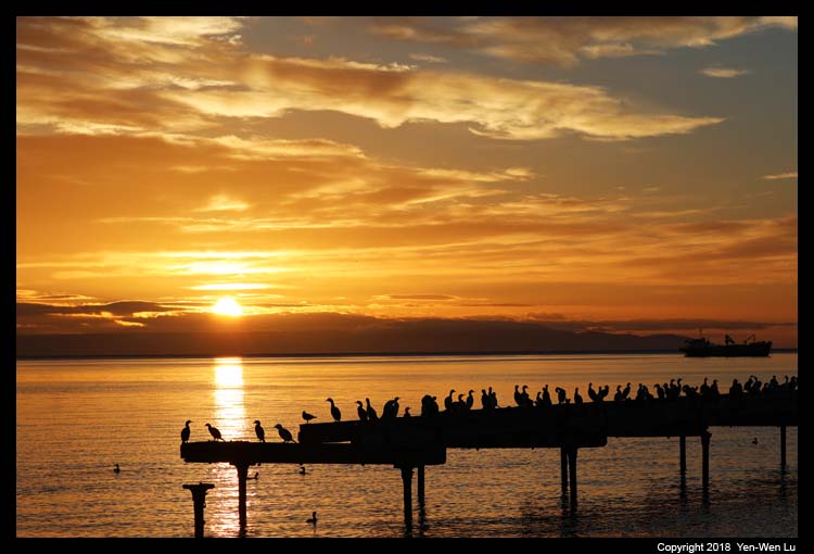
- Punta Arenas Sunrise
It was nice to catch a colorful sunrise
before we departed to Antarctica!
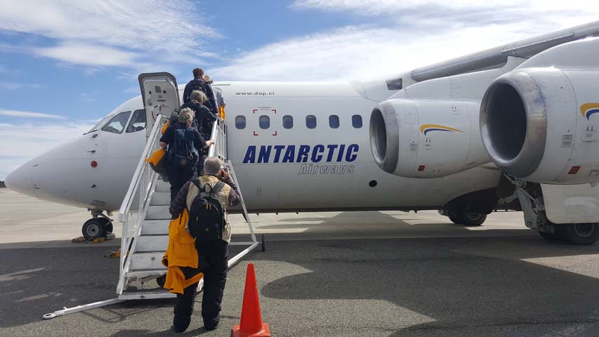
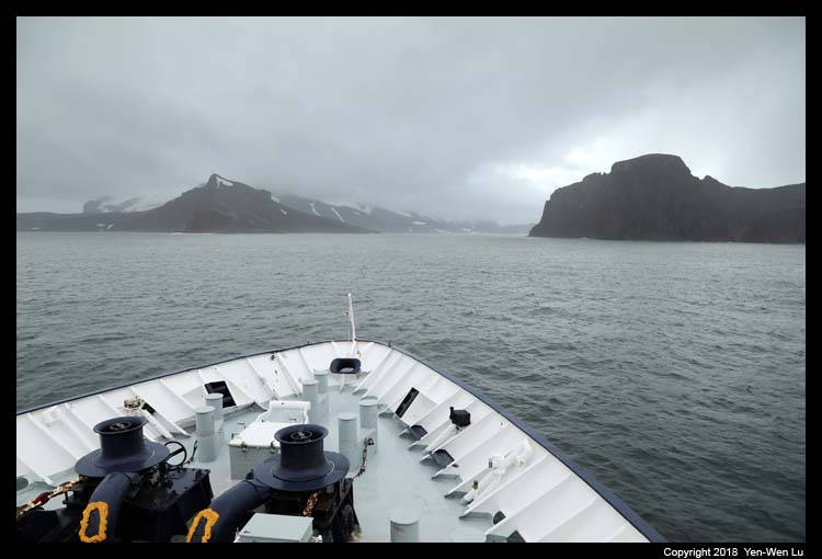
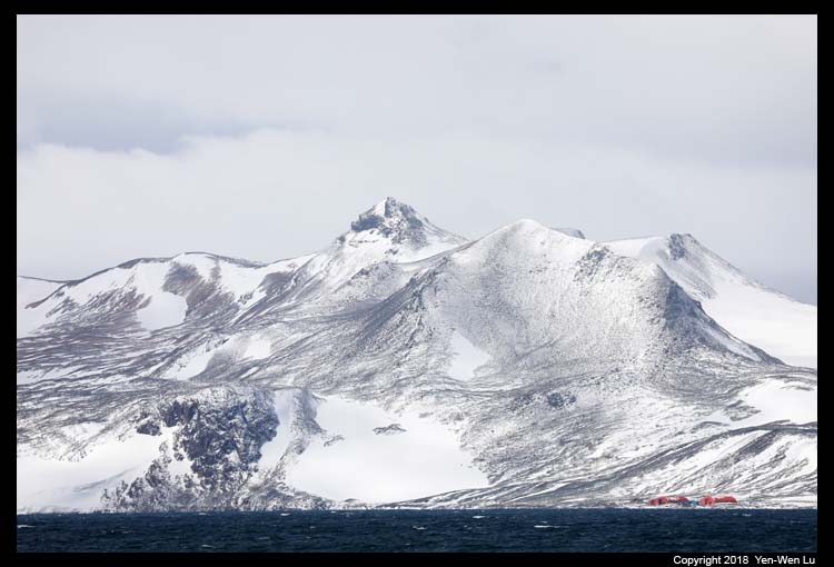
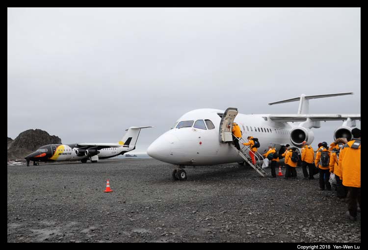
- Flight to King George Island, Antarctica
The flight to Antarctica
is always weather dependent. In our case, it also depended whether
our cruise ship had arrived in position. Our ship was
re-positioned from Ushuaia from its previous tour route and was
scheduled to arrive in King George Island at 1PM to wait for us.
However, the sea was too rough (with 6.5 meters high waves in the Drake
Passage!) and their schedule was still uncertain at 7PM last night.
Luckily we got confirmation in the morning that everything was in a
favorable condition that we will arrive in King George Island at 2PM as
planned.
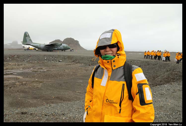
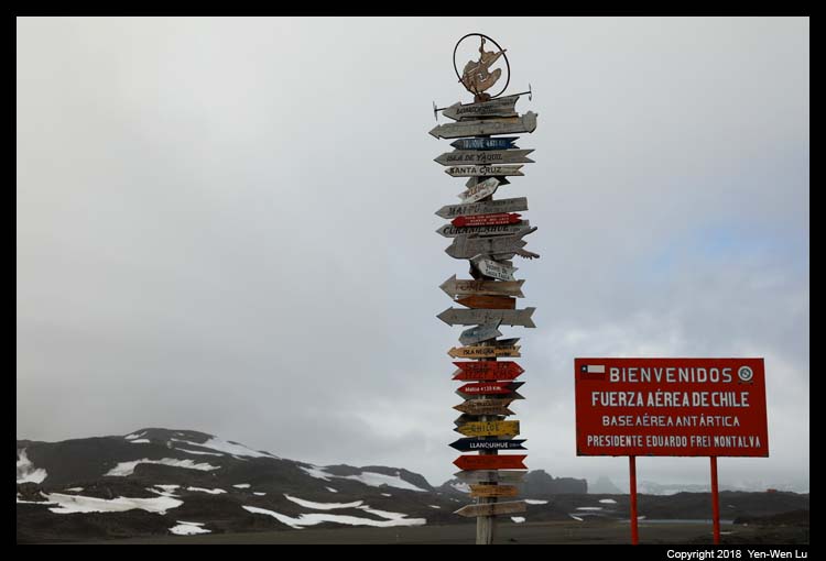
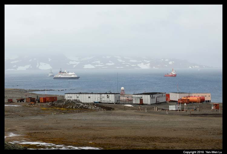
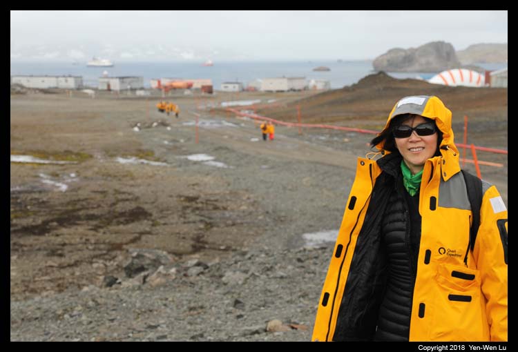
We landed at the Chilean Airforce Base in King George
Island. We were told not to take any picture since it is a
military facility, but we hardly saw any facility at all (only a gravel
runway and an empty hanger). We walked across the island for about
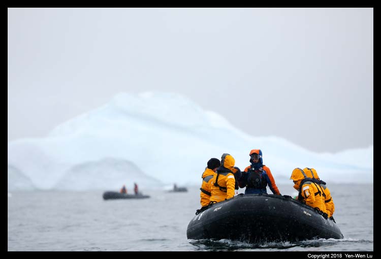
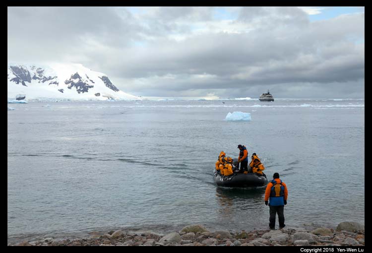
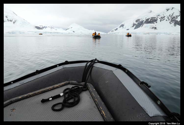
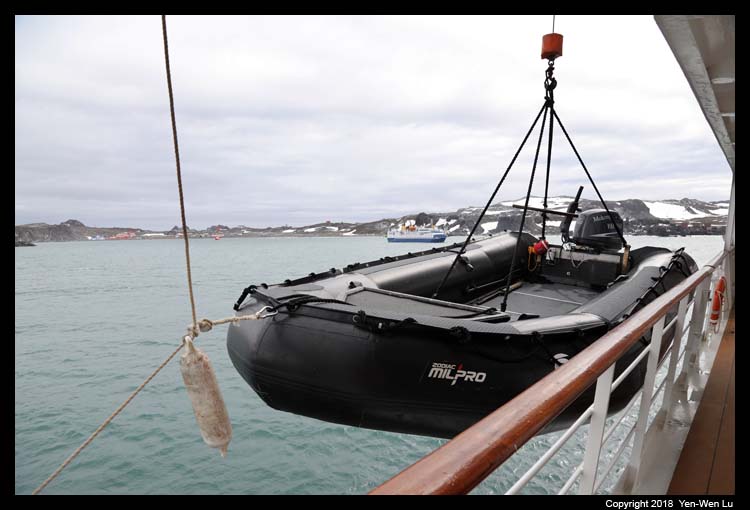
1.5 km and prepared for the first exciting excursion: a Zodiac
ride to our ship, Island Sky.
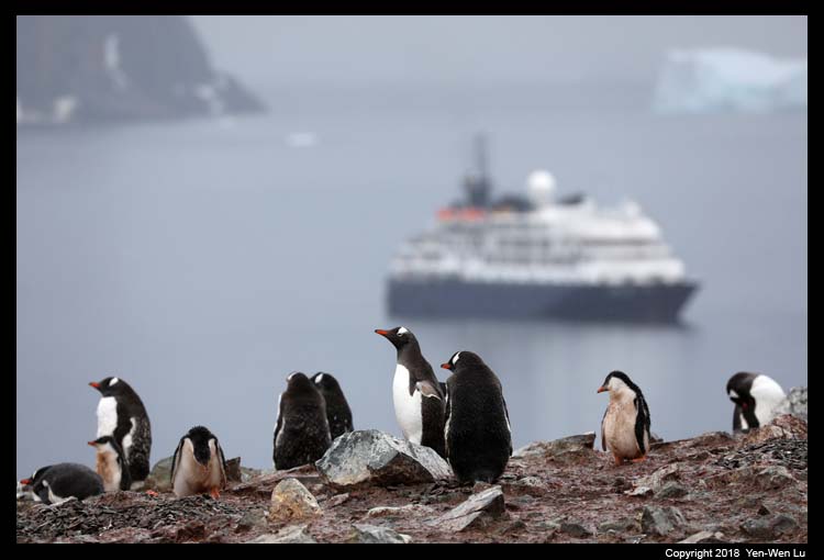
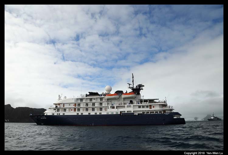
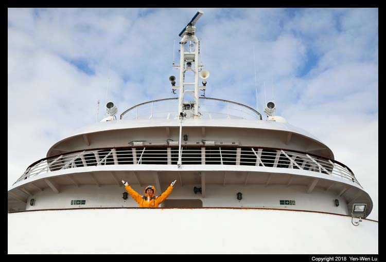
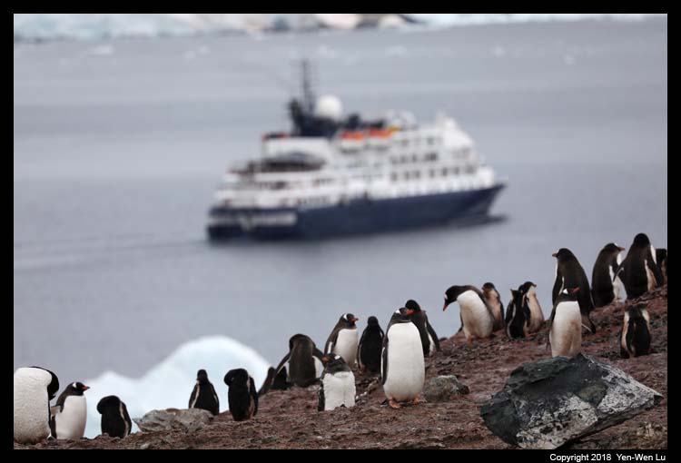
- Aboard Island Sky
The Island Sky is a small expedition vessel
with elegant touches throughout. Carrying a maximum of 106
passengers, the ship provides an abundance of public space for wildlife
viewing, relaxation and taking in lectures and briefings. We
had a late lunch at the
outdoor seating area at the top deck (in fact, this was the only
time that the weather was good enough to have a meal outdoors during our
5-day cruise). The ship has an
open bridge policy
that it welcomes visitors to the bridge when the officers are not at critical tasks.
Day 6 (Feb 6) ...
-
Enterprise Island -- Zodiac Cruise
Enterprise Island lies at the northeast
end of Nansen Island in Wilhemina Bay. It was chartered by
Gertache during the Belgian Antarctic expedition in 1898.
Enterprise Island was known to whalers who operated in this region in
the early 1900's and artifacts from the whaling period can still be seen
in this area.
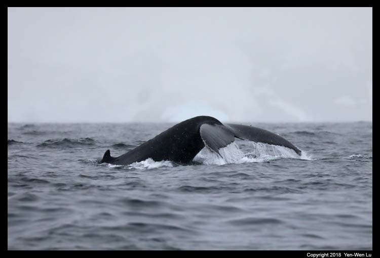
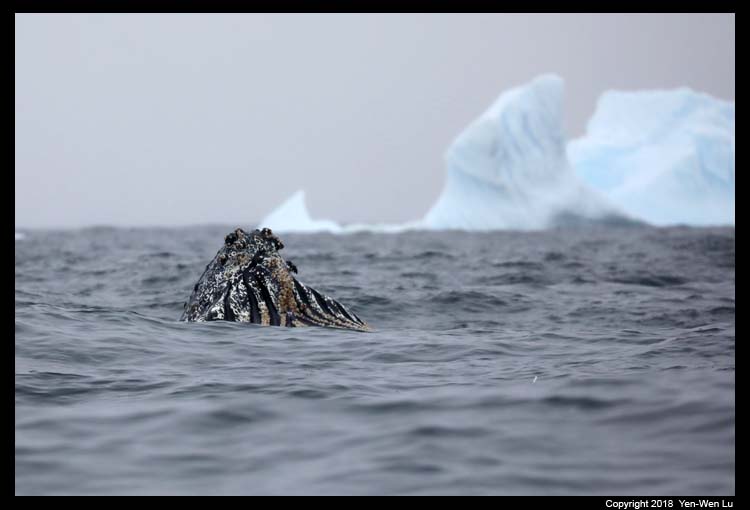
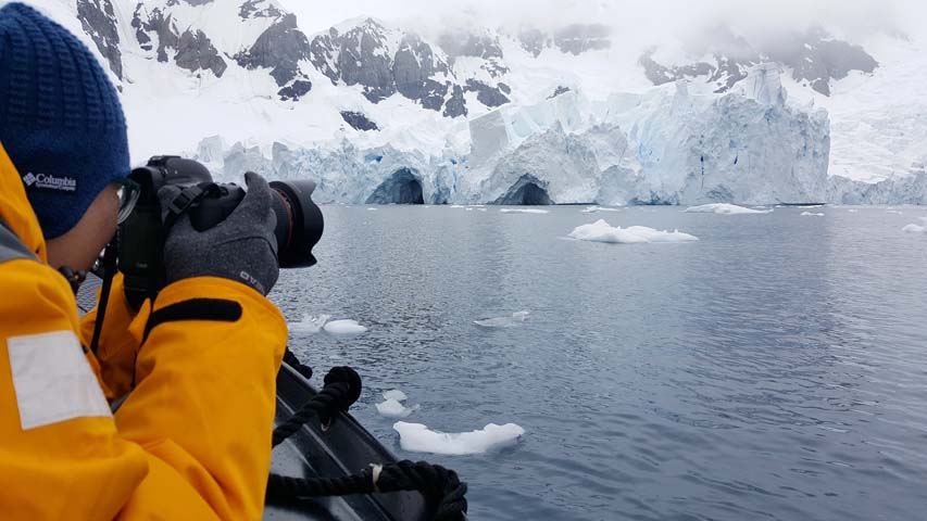
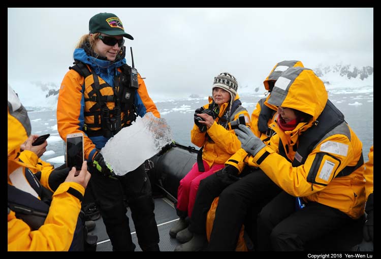
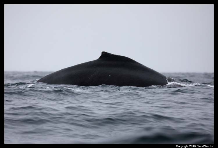
We were both excited and nervous about our first real
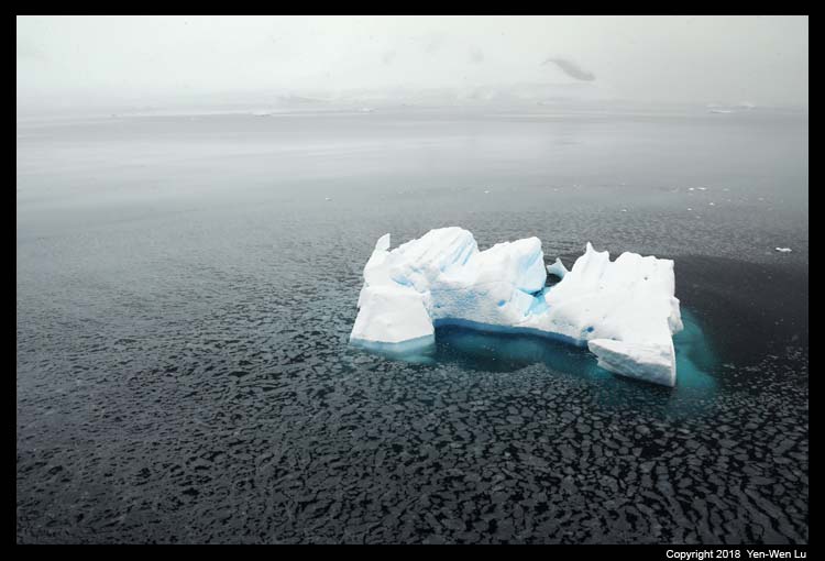
Zodiac cruise. The cruise around the shores and icebergs provided
close encounter with many different wildlife including a small group of
humpback whales which were feeding around us.
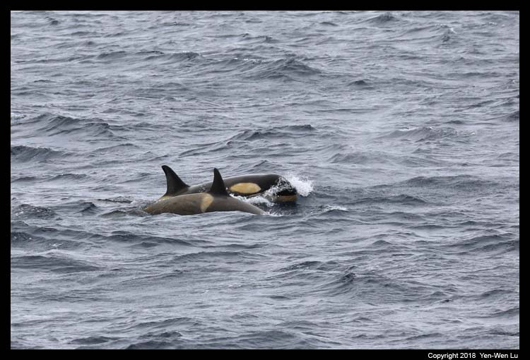
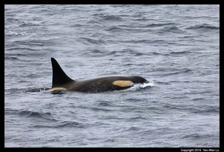
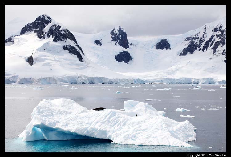
- Antarctica Cruise
Someone spotted a couple of Killer Whales
during our lunch time...
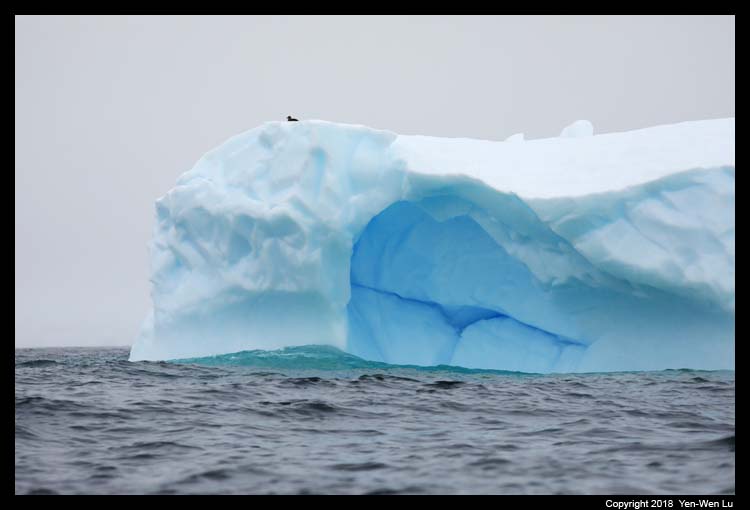
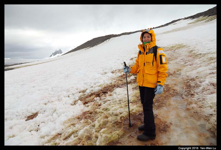
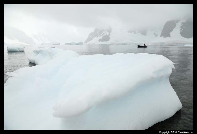
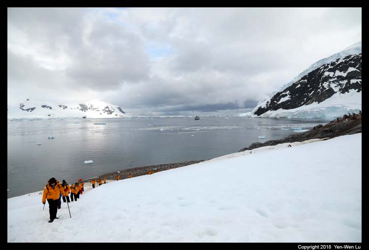
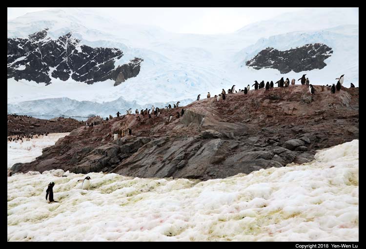
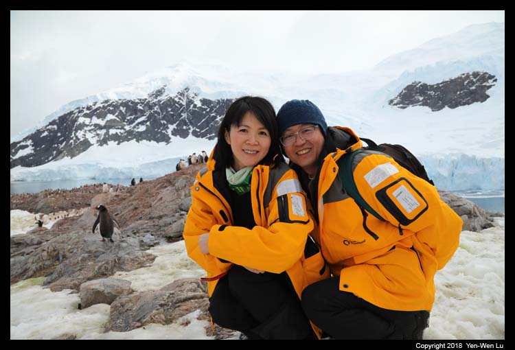
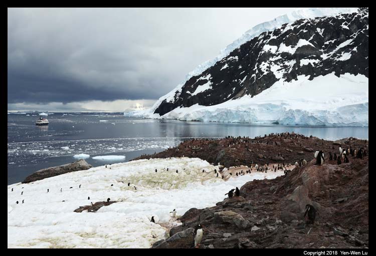
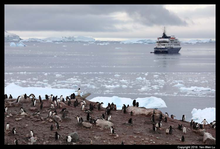
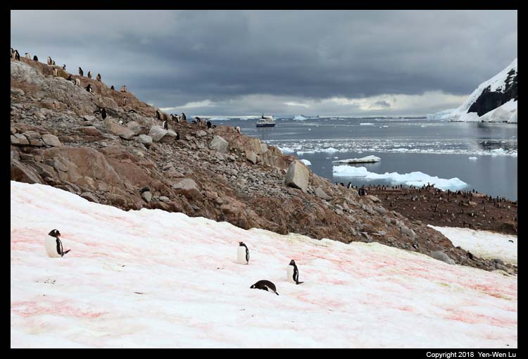
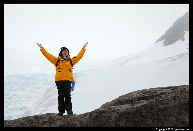
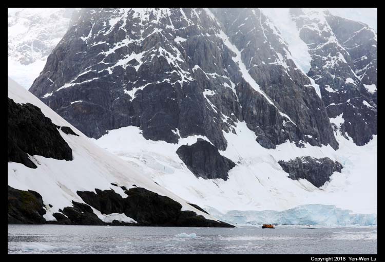
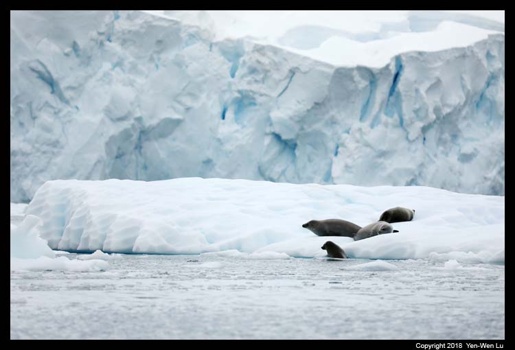
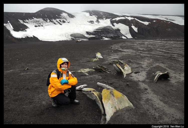
-
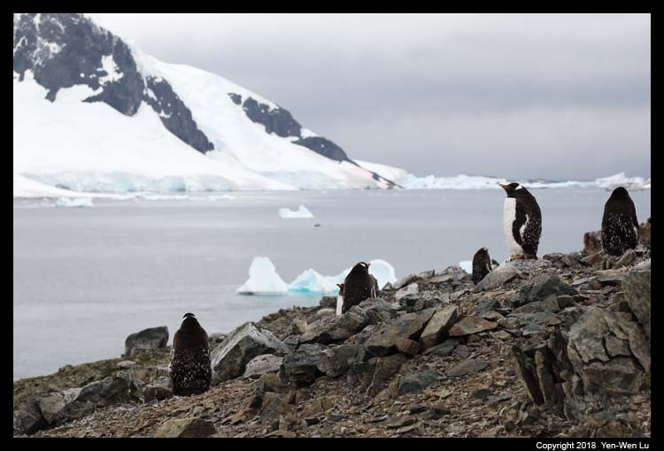
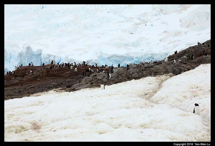
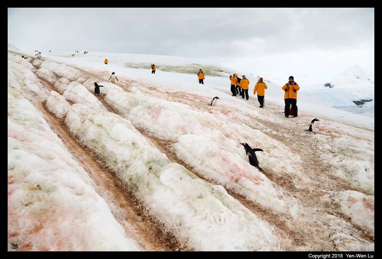
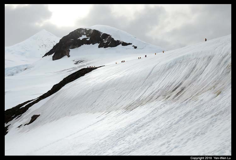
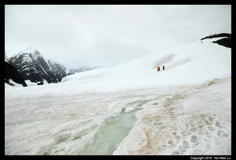
Danco Island
Danco Island lies in the southern end of the
Errera Channel. It is relatively small, 1.6km (1 mile) long, but
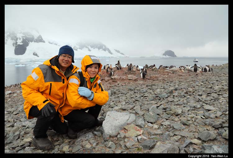
quite high (180m or 590 ft). It was our first Zodiac landing in
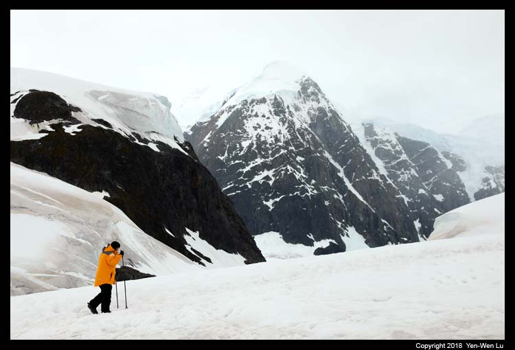
Antarctica and it was the beginning of the adventure. The view
from the top of Danco Island is spectacular with the heavily crevassed
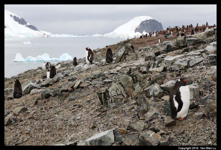
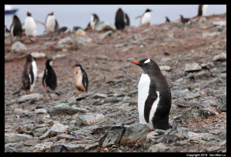
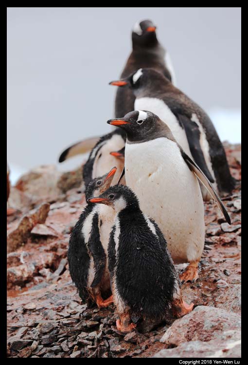
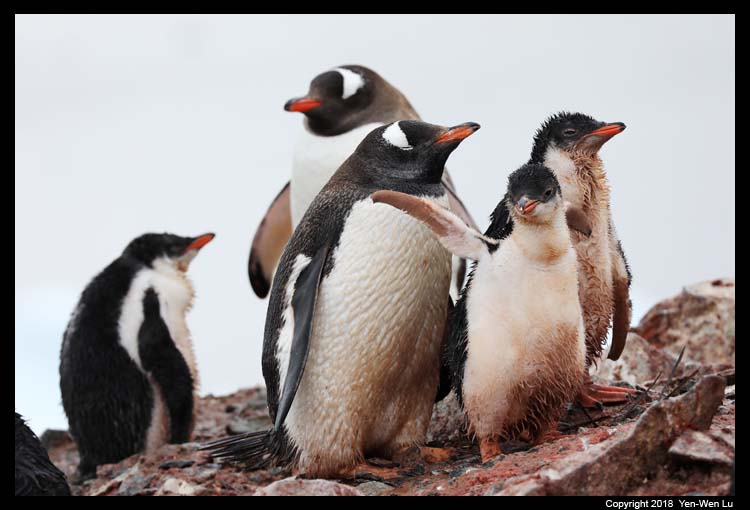
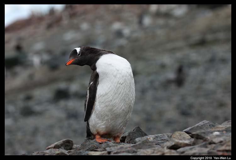
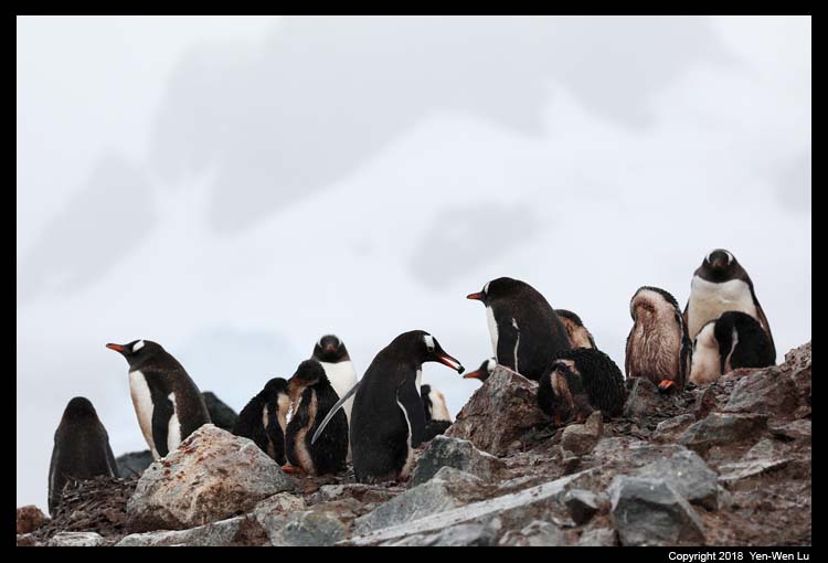
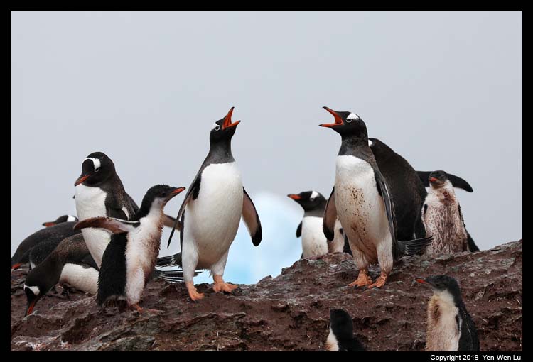
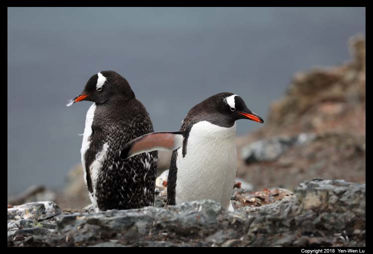
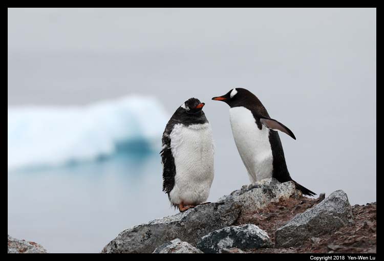
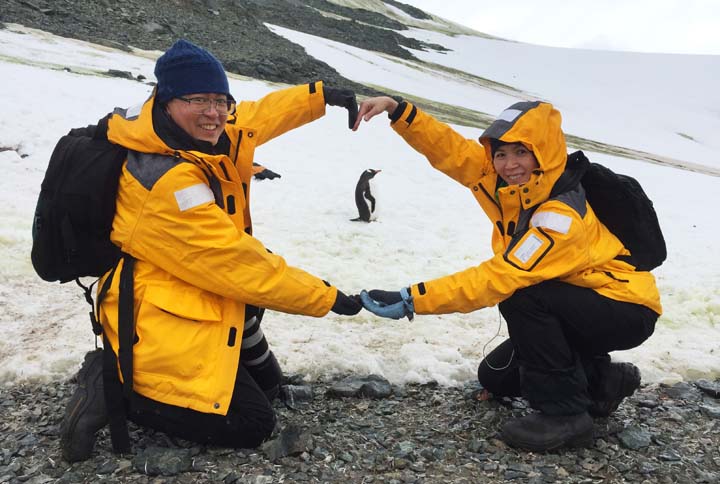
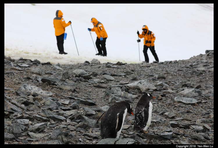
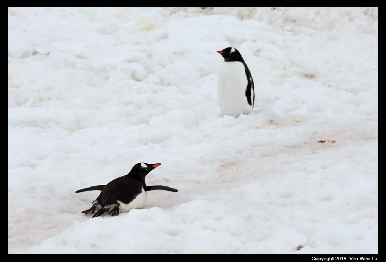
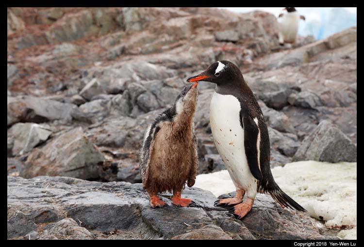
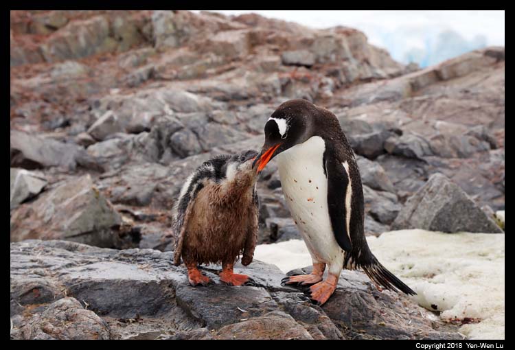
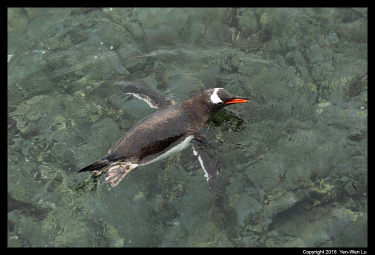
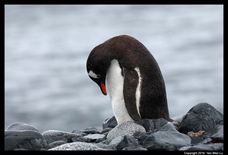
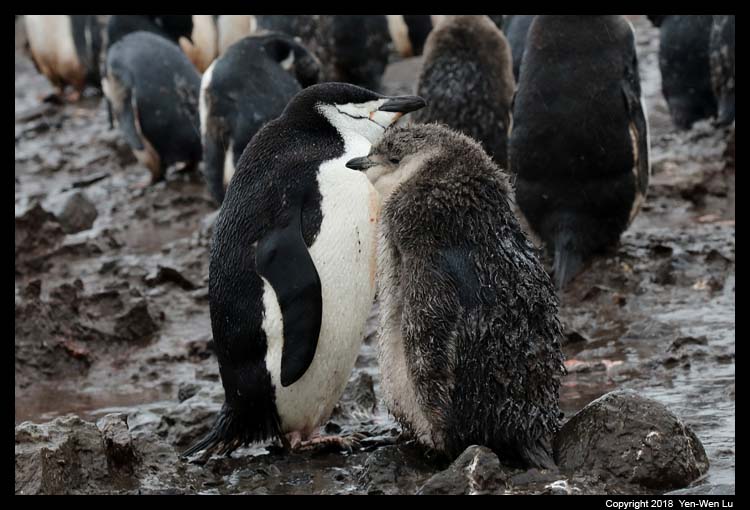
glaciers in the surrounding mountains. Danco Island is home to
approximately 1600 breeding pairs of gentoo penguins which breed quite
high up on the slopes. We were told not to approach any penguin
within 5 meters, but if we stand still then it is OK if penguins
come closer. It turned out it was easy to be surrounded
by penguins if we sit still for a while. It was quite a surreal
experience to be in a totally remote and wild place with such a sight
and sound (and smell...).
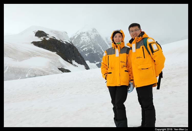
Day 7 (Feb 7) ...
-
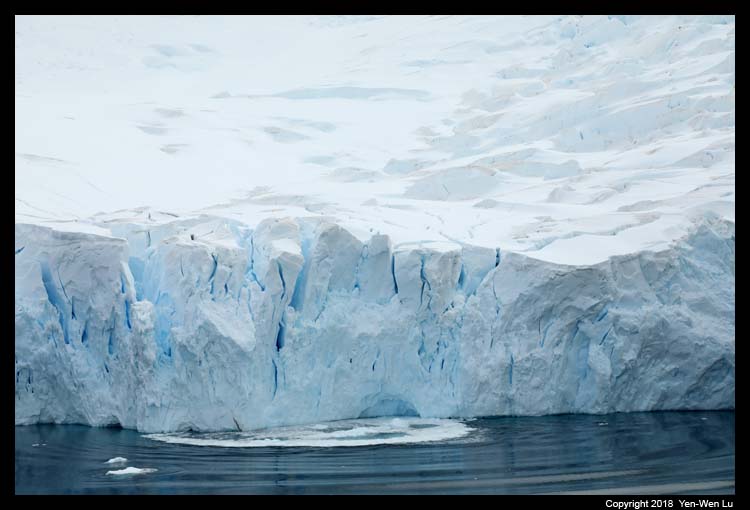
Neko Harbor
Neko Harbor is notorious for its calving
glaciers. The beach area is prone to large and unpredictable waves
following a calving so we were asked to stay off the beach and move to the
high ground as soon as possible after our landing. We climbed up to
a steep slope on the ridge which provides the most spectacular view of
Andvord Bay in our Antarctica trip. The "Penguin
Highway" is also one interesting thing we learned here that how
penguins can move up and down efficiently from their breeding grounds to
the sea back and forth.
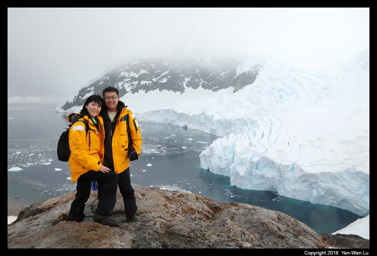
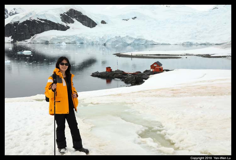
-
Base Brown
Base Brown is an Argentinean base located in
Paradise Bay. This is a summer only station, and we could see some
base personnel working in the buildings. Behind the station is a
50m (165 ft) slope up to a lookout point that offers excellent views of
Paradise Bay. Since I did not feel too good about my knees, I
decided to stay at a mid point to listen to some historical stories by
an expedition guide while Woanyu continued walking up to the top.
The interesting story about the Base Brown goes like this: Brown
Station's original facilities were burned down by the station's doctor
on 12 April 1984 after he was ordered to stay for the winter when
Argentina lost the Falklands War and had financial difficulty to take
them back home. Luckily the station personnel was rescued by the
ship USS Hero and taken to United States' Palmer Station.
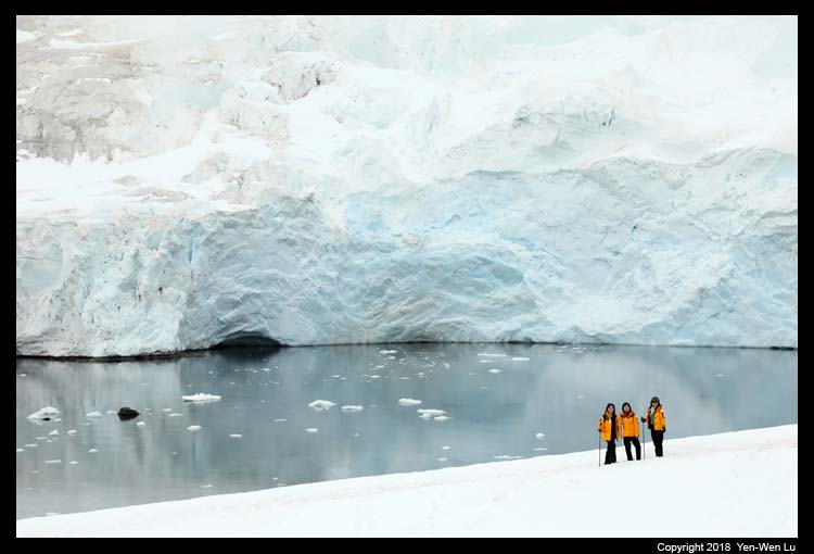
-
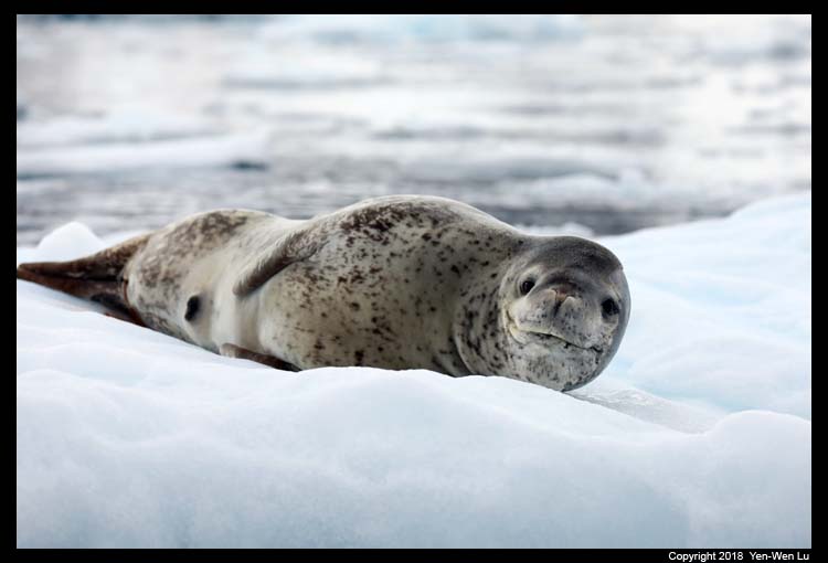
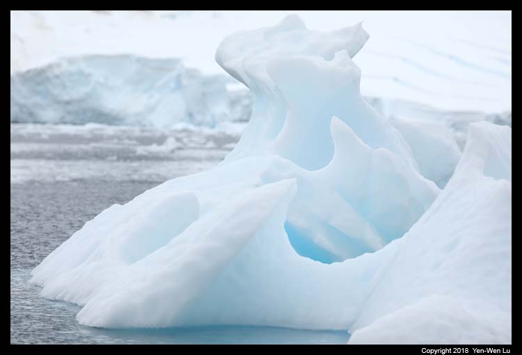
Paradise Harbor -- Zodiac Cruise
We were back to Zodiac from the Base Brown
and had a nice Zodiac cruise (amazing landscape, icebergs, seals, birds, etc.) in
the Paradise Harbor. The Paradise Harbor, also known as Paradise
Bay, was named by whalers in 1920's because it is such a protected
anchorage.
Day 8 (Feb 8) ...
-
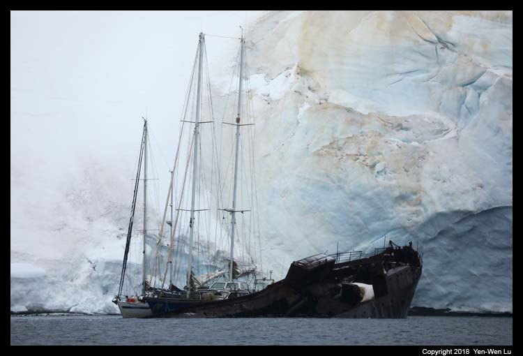
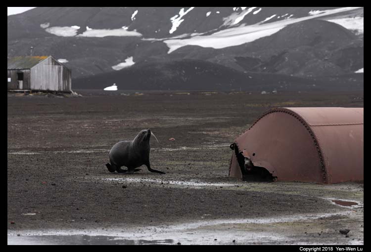
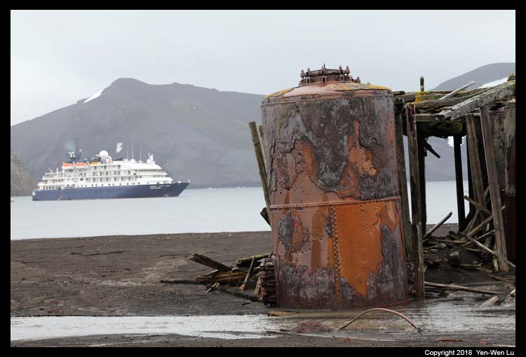
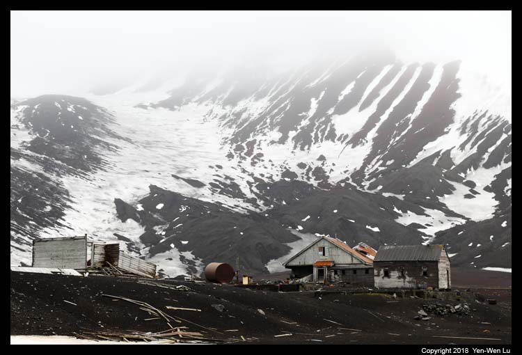
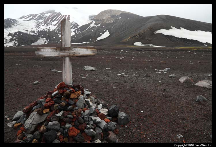
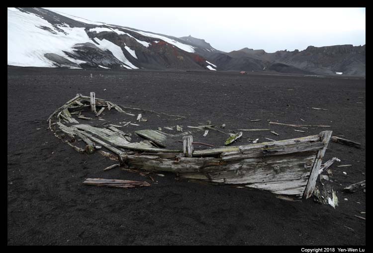
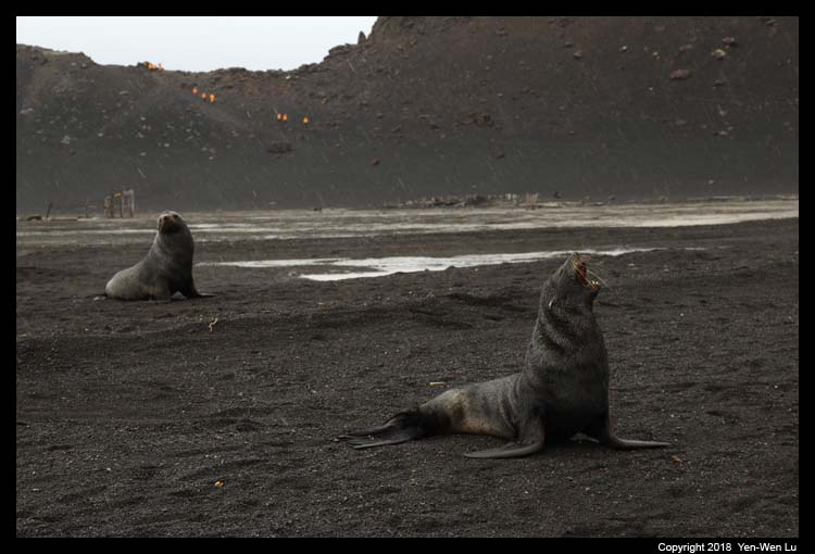
Whaler's Bay,
Deception Island
Deception Island is an island in
the South Shetland Islands archipelago. Deception Island is actually
the caldera of an active volcano, which seriously damaged local
scientific stations in 1967 and 1969. To reach Whaler’s Bay,
it is necessary to sail through a narrow passage called Neptune’s
Bellows. The bay was used by whalers from 1906 to 1931 and is part of a
protected harbor created by the formation of the circular flooded
caldera (known as Deception Island). It was kind of cool to see
our ship steer toward the small opening of the caldera and realize we
were inside an active volcano. Remains of previous structures at
Whalers Bay include rusting boilers and tanks, an aircraft hangar and
the British scientific station house (Biscoe House), and a cemetery
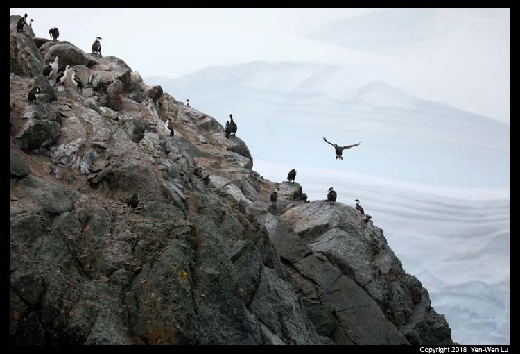
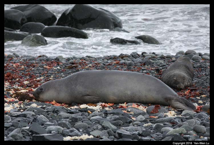
containing 35 burials and a memorial to ten men lost at sea. In
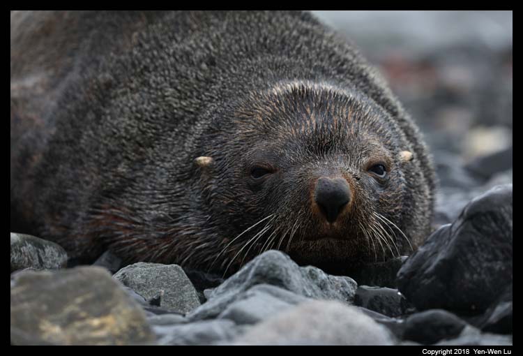
addition to the historical remains, there were many active fur seals
around the beach and it was hard not to step into their territories.
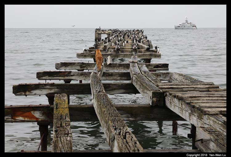
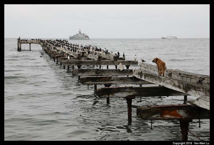
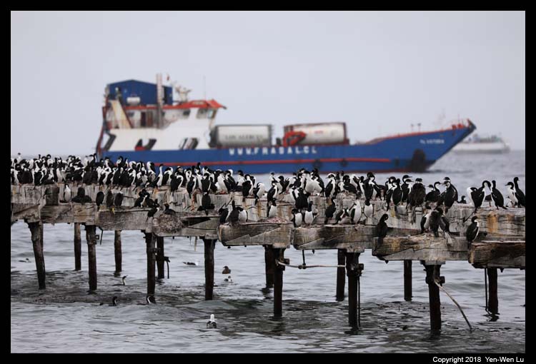
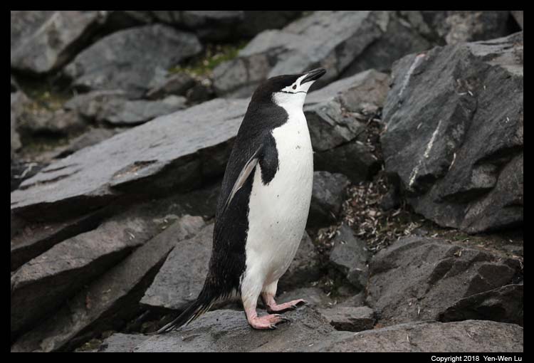
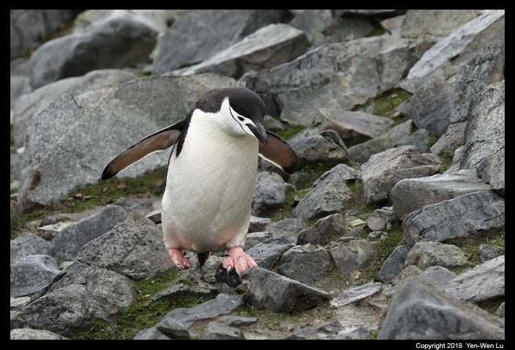
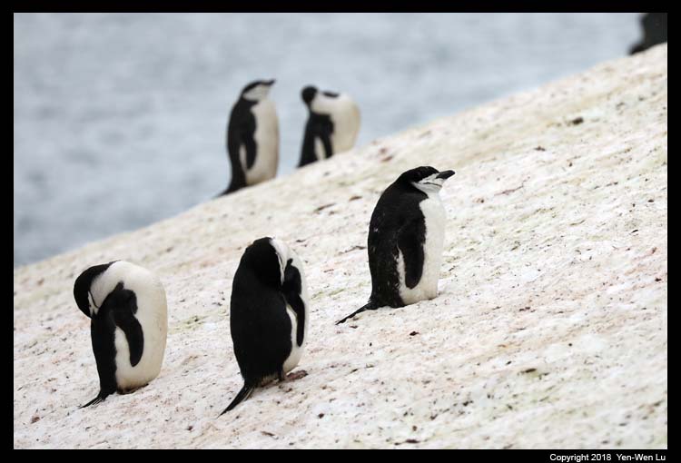
-
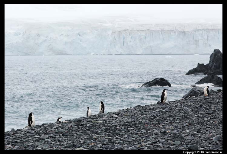
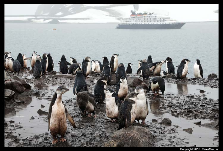
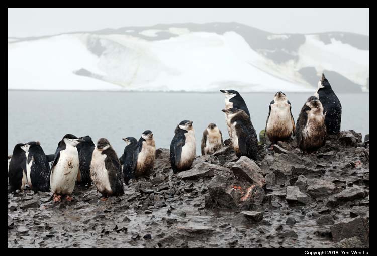
Half Moon Island
This crescent-shaped island was known to
sealers as early as 1821. The island has been identified as
an Important Bird Area (IBA) because it supports a breeding colony of
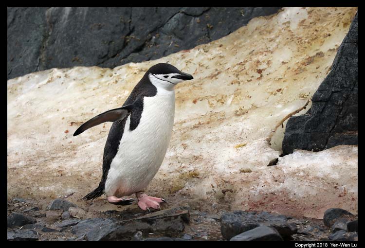
many Antarctic birds including chinstrap penguins, shags, Wilson’s storm
petrels, kelp gulls, snowy sheathbills, Antarctic terns and skua.
The island is a popular stop for Antarctic cruises. There is a
2,000 m walking track on the southern part of the Island which allows
tourists to get a close view of the wildlife (mainly chinstrap
penguins), and of the surrounding mountainous scenery
The weather had changed significantly after we were
back to the ship in the late afternoon. The wind and wave were much
stronger and the ship was
beginning to rock both back-and-forth and left-and-right. Many
people started to show signs of sea sickness. There was a Captain's
Farewell Cocktail at the lounge at 7:30PM, but there were less than half of
people showing up. Since Woanyu did not feel too well and decided to
go to bed early (with additional sea sickness medicine), we even skipped the
Farewell Dinner (and we heard only less than 1/3 people attended the
dinner...). I now really felt we made a right choice to take the
"Fly-the-Drake" option to visit Antarctica!
Day 9 (Feb 9) ...
- King George Island
We were back
to the King George Island in the morning when the sea calmed down.
We were in the "stand-by" mode to wait for the incoming flight (which
will bring the next tour group). The original plan from yesterday
was they should arrive at about noon so we need to prepare to get on the
Zodiac at around 10-11AM. However, the weather and runway
condition (too icy) delayed the schedule so we had additional lectures
and slideshow in the morning, and we would start to disembark at 2PM.
After more waiting, we were finally notified that our flight was on the
way and we began to load on to Zodiac at 3PM. Since we had to wait
for the 2nd plane to land before we could take off, we could not board
our plane (we were in the first flight group) until almost 6PM...
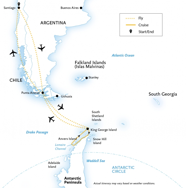
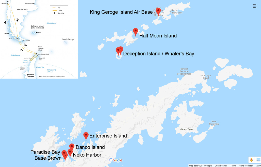
Here is the map of the detail locations of all our
landing/cruising excursions. I think we were very lucky to have good
enough weather for the entire trip that we could fully utilize all days we had in Antarctica and
we were able to visit and see all sites and wild animals we planned to see.
Next ...
We were back to Punta Arenas in the evening and had a late dinner (after
9PM) in a nearby restaurant, and prepared to move on to
the 2nd part of our trip: Patagonia.
[Antarctica
Gallery]
[Back to Photo Page]


