The Colorado Plateau in the southwest (Utah, Arizona), home of
more than 20 national parks and monuments, is a beautiful
sculptured wilderness with brilliant colors. Each national park
lies on the Plateau is unique and precious. Arches National
Parks, in the northeastern quarter of the Plateau, encompasses a
unique concentration of spectacular landforms. More than 2000
arches spanned in the park, ranging from small windows to one of
the longest in the world, Landscape Arch, which measures 306
feet. Canyonlands National Park preserves a wilderness of rock at
the heart of the Colorado Plateau. Water and gravity have been
the prime architects of this land, cutting layers of rocks into
hundreds of canyons, mesas, buttes, fins, arches, and spires.
Surrounding the Green and Colorado rivers are vast and three very
different regions: Island in the Sky (north), the Maze (west),
and the Needles (east).
Getting there ...
This is my first real "photographic" trip in years.
My families are still in Taiwan for Chinese New Year, and my
friends Fred and Wendy asked me if I'd like to come along to this
wonderland to take pictures. Without family duties, it was a very
different experience for me this time (no portraits!). We had an
early flight (6:20AM) to Salt Lake City, and Fred came to pick me
up at 4:30AM! It's about 4-hour drive from SLC to Arches, and it
was before 3PM when we got to Moab, where we were going to stay
for 3 nights. Moab is a very well developed town for tourists:
numerous hotels and restaurants ranging from fine cuisine to all
kinds of fast food.
- Balanced Rock, the Windows, and Delicate Arch Viewpoint
After a short break in the hotel (Best Western), we
headed to Arches National Park. The weather was not good;
it was cloudy, drizzling with the worst quality of light.
We walked around the Windows, and Fred found the place
where people take the classic view of "Turret Arch
in the North Window", where you need to climb down
and up to the other side of the window. Unfortunately,
the light was so poor that all of the shots were thrown
away (well, at least they were all digital).
The Second Day (Arches) ...
- Sunrise at Window
We went back to the North Window to wait for sunrise. The
sky was still cloudy and no sign of improvement after
sunrise. I managed to get a few shots with different
exposures although I knew I could not get anything
decent under this lighting condition. After we finished
here, we took a short walk to the Double Arch which is
just on the other side of the parking lot.
- Park Ave
From the parking area (at the southern end), the trail
descends into a spectacular canyon and continues down the
wash to Courthouse Towers (at the north end). I liked the
view at the trailhead very much. We were surrounded by
the tall walls and I felt the scene was so magnificent. I
actually did not finish this 1-mile one-way trail since I
had to turn back and drove to visitor center .......
- Fiery Furnace
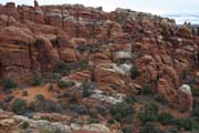 |
The Fiery Furnace is a mazelike
labyrinth of narrow sandstone canyons. Any
visitor entering the Fiery Furnace must obtain a
hiking permit or join a ranger-guided hike (only
offered from April to October). We only stopped
by the view point to take a quick look. |
- Devils Garden
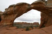
The Broken Arch trail is a 1.3-mile loop passed through
open grassland and into the canyons with thin fins. When
we were in the canyon section, I knew it will be one of
Linus' favorite trails. The trail went under the arch
where you can see that it's "broken" in the
middle, which made us nervous and move faster. After the
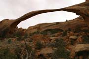
lunch picnic at the campground, we took the Devils Garden
trail headed to one of the longest arches in the world,
the Landscape Arch, which measures 306 feet from base to
base. The light was still flat, but it was OK since the
arch is facing east and we should come here in the
morning if the sun goes out.
 |
 |
 |
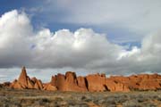 |
| Broken Arch |
Landscape Arch |
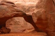
Sand Dune Arch |
Devils Garden |
Sand Dune Arch is accessible via a short walk just from
the roadside. The trail leads through deep sand to a secluded
arch among sandstone fins. The sun has peeked through cloud
quietly and the arch was bathed in warming red light bounced
from the canyon.
- Delicate Arch
Delicate Arch is no doubt the icon of the Arches National
Park, and the state of Utah, and probably even the entire
Southwest areas. The 1.5-mile (one-way) trail climbs 480
feet to the arch. In the tour guide, it says "just
before you get to Delicate Arch, the trail goes along a
rock ledge for about 200 yards". However, we missed
the trail before that and got to the wrong side of the
cliff. There was no man-made trail although it did look
like a rock ledge with minimal footing. I was able to
manage my balance and got to the flat area, but Wendy and
Fred decided to turn back and ask for right direction.
When I went back through the correct trail path, I met
Fred and Wendy in the middle of the ledge where there is
a small window opening which you can see Delicate Arch
through the hole. It frames the arch nicely and gives us
a very different perspective.
Since Fred was working with his large format camera,
Wendy helped him carry equipment, prepare for setup,
handle films, etc. without complaint, which remind me of
Woanyu 10 years ago :-) We were so lucky that we got the
perfect weather/lighting condition at the prime location
after two days of frustration. I don't think I can ask
anything more.
The Third Day (Canyonlands) ...
- Sunrise
We went back to the Windows in Arches again this morning.
It was rainy and windy, and we did not even get out of
the car.
- Dead Horse Point State Park
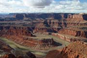 |
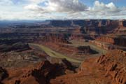
Towering 2,000 feet above the
Colorado River, Dead Horse Point State Park
provides a breathtaking panorama of Canyonlands'
sculptured pinnacles and buttes. The highlight of
the park is at the viewpoint of southern tip
where the Colorado River bends 180 degrees. |
 |
- Island in the Sky, Canyonlands
Canyonlands National Park consists of three distinct
regions: Island in the Sky (north), the Maze (west), and
the Needles (east). Island in the Sky is the most
accessible region and is only 32 miles from Moab. Views
from Island in the Sky reach from the depths of the Green
and Colorado Rivers to the mountaintops and above.
Closest to the mesa's edge is the White Rim, a nearly
continuous sandstone bench 1,200 feet below the Island.
Another 1,000 feet beneath White Rim are the rivers,
shadowed by sheer canyon cliffs.
- Shafer Canyon
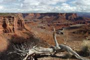 |
The first view of the canyon
will remind anyone of Grand Canyon. |
- Mesa Arch
Like Delicate Arch in Arches, Mesa Arch in
Canyonlands is probably one of the most recognizable
formations (or photos) in the park. I have seen its
photos with the arch partially in the frame (like this one),
but when I first saw the arch
at the end of the trail, I was surprised that it was
not big at all.
- Upheaval Dome
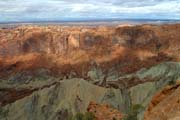 |
The jagged core of Upheaval
Dome reveals a jumble of White Rim Sandstone
ringed by slopes of Moenkopi and Chinle
formations which rise to Wingate and Kayenta
cliffs. The origin of this crater-like
structure is uncertain. Although it is
geologically interesting, it may not be a
good object for photographers IMHO. We only
hiked to the first overlook to get some
pictures. |
- Green River Overlook, Buck Canyon Overlook
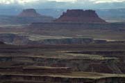
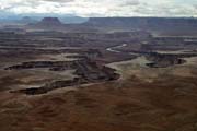
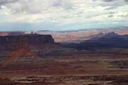
After lunch at the Upheaval Dome area, we headed
south to see more canyons in the park.
 |
 |
 |
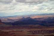 |
| Green River Overlook |
Buck Canyon Overlook |
- Grand View Point
Grand View Point is a vast panorama offering
magnificent vistas across the Colorado canyons, to
the distant La Sal Mountains in the east and the
Needles area to the south. It is situated high above
the north side of a complex system of canyons known
as Monument Basin. A further 1-mile trail leads to
the very end point of the Island plateau, where the
cliffs drop away in all directions, and the canyons
of both rivers can be seen.
- Back to Dead Horse Point
We went back to Dead Horse Point for sunset (since we had
already paid the entrance fee this morning). Although the
river bend is too close to the western side of canyon and
the sunlight cannot reach the river at this time of a
day, it still provides nice views of canyons around all
directions with warm colors.
The Last Day,
- Mesa Arch
I wanted to go to Mesa Arch to get the photo where the
red light illuminated under the arch, but my friend Fred
still wanted to go to the Windows in Arches to get the
"Turret Arch in the Window". After negotiation,
we decided that I'll drop Fred off at the Windows at
5:30AM, and I'll go to Mesa Arch in Canyonlands, then
I'll come back to the Windows to pick Fred up at 8:30AM.
When I got to Mesa Arch, I was surprised that there were
already 5 other folks waiting there with tripods aligned
under the arch. There was a little bit too much cloud
this morning which diffused the golden color. The timing
was so important to get the bottom of the arch
illuminated with the warm color, which only last for a
few minutes.
I went back to Arches at around 8:40AM and Fred just
walked out to the parking lot. The timing was perfect and
both of us got what we want.
- Back to Arches
Since we still had a half day to spend, we decided to go
back to Arches for those vistas where we did not get good
shots because the bad weather on the first day.
From the park newspapers, they have compiled a feature
list for photographers to decide where to go at the right
time.
Going Home ...
After lunch at the picnic area around the Balanced Rock, we
began our 4-hour drive back to Salt Lake City. We rented a SUV
this time, but we did not actually use it to explore any back
roads. I know I will come back to these national parks again with
my family in a few years since I don't think they want to miss
these wonderful places. When we come again, we will try to visit
some more remote areas with 4-wheel-drive access.
[Back to Photo Page] [Go to Arches Gallery] [Go to
Canyonlands Gallery]