Lightly visited and remote, Big Bend National Park is one of
the least known but perhaps the most appreciated of the national
parks. Located at the boundary between the United States and
Mexico, three states abut at Big Bend: Texas in US, and Coahuila
and Chihuahua in Mexico. The Rio Grande is the 2nd -longest river
in North America, flowing 1885 miles from Colorado to the Gulf of
Mexico. Desolated badlands, forested mountains, sun-baked
hillsides, deep canyons, and a long island of green supported by
the Rio Grande's flow, all can be found in this 800,000 acres
sanctuary.
Getting there ...
We had an early morning flight at 6:35AM. We arrived at the
airport at about 5:30AM, and found ourselves stuck in long lines
of luggage and security check-ins. We finally went through the
security and got to the gate at 6:33AM, and found our plane was
already gone!!! We had to arrange to get to the next flight about
an hour later (which was actually delayed by more than half an
hour). When we got to El Paso at ~ 2PM (Mountain Time), our
luggage was already there because they got on the original
flight, and we were already 2 hours behind schedule.
It's a long drive from El Paso to Big Bend ( ~ 5 hours
driving). With a short stop for some supply at Alpine, we finally
got to Big Bend (Motor Inn @ Study Butte) at ~ 8PM (Central
Time), and we were still confused with the different time zones.
The Second Day ...
- Sunrise
I drove into the park, and found a spot at the Santa
Elena Junction for sunrise. The cool morning air in
desert gave me a fresh start for the day.
- Santa Elena Canyon
The Rio Grande carved three magnificent canyons in Big
Bend: Santa Elena, Mariscal, and Boquillas Canyons. We
drove the 30-mile Ross Maxwell Scenic Drive to the end to
the Santa Elena Canyon. At Santa Elena, the Rio Grande
has cut a 1500' vertical chasm out of pure limestone, and
the opening of the canyon can be seen far away from the
road.
The 1.7-mile roundtrip trail is one of the grandest
spectacles in the park. After crossing Terlingua Creek,
the trail climbs several short switchbacks and then
gradually descends along the banks of the Rio Grande. We
were surrounded by lush riparian vegetation and
1,500-foot towering vertical cliffs. The trail ends where
canyon walls meet the river and where Linus and Iris
enjoyed some touch of the water.
- Ross Maxwell Scenic Drive
After a quick lunch picnic at Santa Elena, and a short
break at Castolon, we drove back on Ross Maxwell Drive
and stopped at a few vista points, including the Mule
Ears Viewpoint. The Mule Ears Peaks are made of lava, and
are an example of the dramatic landforms seen in the
western Big Bend that are tied to volcanic activity.
Since Woanyu injured her knee 2 weeks before the trip
during an ice skating session, we could not hike too much
in this trip. We only walked for about 20 minutes on the
Mule Ears Trail to get a nice view of those peaks.
- Sunset
When we walked back to our room after dinner, I ran to
get my camera to snap a few shots before the sun set
down. These shots were taken just about 10 steps from our
room.
The Third Day ...
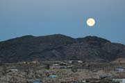
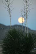
- Moonset
.

|
I could not go out for sunrise
because we needed to prepare to leave early for
the river trip today. But I still managed to get
a few moonset pictures just outside our room. You
may recognize the same plant in the moonset shot
as in the sunset shots from yesterday. |
 |
- Hot Spring Canoe River Trip
The highlight of this Big Bend trip was the Canoe Trip
which I booked at Big Bend River
Tour. It was the lower water season and they only
offered this type of canoe trip, which was perfect for us
since it was our first time to try canoeing, and we did
not expect something too adventurous anyway. We met our
guide Erin at their office at 7:45AM, and everything was
ready for us to go. The tour started at the Gravel Pit,
reached by the unpaved River Road East, and ended at Rio
Grande Village with total about 6 miles long.
After a quick lesson about paddling a canoe, we started
our river journey passing through small scenic canyons on
water that is calm with perfect reflection along the
river banks. Iris liked to help paddling too, but she
often switched sides randomly without any reason, which
made me nervous initially although the water was only
waist-level (or less) most of the time. We stopped by a
small secret hot spring which is only reachable by boat,
and Linus and Iris enjoyed playing mud without worrying
getting too muddy. After a short break, we continued our
easy paddling downstream.
We arrived at the Hot Spring area at about noon. After a
short hike around the ruins, we had a picnic lunch prepared
by our guide Erin, and then went to the hot springs to have a
nice long soak. The waters of the hot springs were considered
a cure all for many ailments in the early 1900's. We
reboarded our canoes after the relaxed hot spring bath, and
started to experience a few mild rapids where we made it
easily although we had some over corrections and moved
backwards. On the way to Rio Grande Village, we stopped
somewhere on the Mexico side, and did a short hike up a hill
into Mexico.
It was about 3PM when we reached our destination at the Rio
Grande Village to end this wonderful journey.
- Terlingua Ghost Town
After dinner, we went to the ghost town in Terlingua.
It's an abandoned old mining town, but is alive again
with a few tourist attractions, restaurants, and hotels.
The Fourth Day ...
- Sunrise
I went back to a few vistas with views of Chisos
mountains and Santa Elena Canyon. The sky was too clear
to have a dramatic sunrise color though.
- Lost Mine Trail, Chisos Mountains
We headed to the Chisos Mountains after breakfast, and
started to explore the center portion of Big Bend. We
took the 4.8-mile roundtrip Lost Mine Trail when we first
entered the Chisos Mountains. This moderately difficult
trail begins at an elevation of 5600' and steadily climbs
to the top at 6850', overlooking Pine and Juniper
Canyons. Because Woanyu's injury, we did not finish the
whole trail. We turned back at the trail marker #17
(there are total 24 markers along the trail according to
the trail guide), where we could already enjoy the great
view of the canyons.
- Window at Chisos Basin
After a good lunch at the restaurant at the Chisos Lodge,
we went to the Window View Trail, which is an easy
0.3-mile walk.
- Chisos Basin Loop Trail
Since our room in the Chisos Lodge was still not ready
when we were back from the Window View at ~ 2PM, we
decided to take the Chisos Basin Loop Trail while Woanyu
took a rest in the restaurant where there was Wi-Fi
available. The Basin Loop Trail is a 1.6-mile loop
connecting the Laguna Meadow and Pinnacles Trails with
350' elevation gain. Linus, Iris, and I had a good walk
and chat while enjoying the view along the way.
- Sunset at Window
The Window View Trail is one of the best viewpoints for
sunset in Big Bend. Iris went with me to the Window, and
gave me a few good suggestions :-)
The Fifth Day ...
- Grapevine Hills
Woanyu decided to stay in the hotel room and let us take
the hike in Grapevine Hills alone. Grapevine Hills Trail
is 2.2-mile roundtrip with the famous "Balanced
Rock" at the end of the trail. After about 1-mile
easy walk following sandy wash, the trail began to climb
massive boulders, and everything started to become very
confusing. We found a few rock cairns which we thought
they marked the trail, but after about an hour of
struggling, we were lost and could not find the Balanced
Rock :-( Iris kept complaining about all the thorns that
were scratching her badly; Linus had a ball of cactus
stuck in his ankle, and I had to use my Swiss Knife to
poke the ball of cactus out, and finally we were forced
to turn back without finding the Balanced Rock. After we
reached the car, we made a unlikely assumption: the
Balanced Rock had fallen.
- Boquillas Canyon
After lunch back at Chisos Lodge, we headed to the east
side of the park to the Boquillas Canyon. From the
parking area at the end of the Boquillas Canyon Road, the
trail climbs over a low limestone hill and drops to the
banks of the Rio Grande near mouth of Boquillas Canyon.
Along the trail, there were quite a few artifacts
(sticks, rocks, crystals, etc.) made by local Mexican and
put there for tourists as souvenirs and to collect some
money. After we reached the end of the trail, we found a
nice shady spot that Linus and Iris played sand, rocks,
leaves, branches to make their own "medicine".
It was hard to ask them to leave until Iris had nose
bleeding (probably it was too hot as it was 90 deg F at
the river band) and could finally find a good use of
their medicine.
The Last Day,
- Sunrise at Window
We were busy in packing in the morning that we need to
check out early. I could not resist to grab my camera to
run out to the Window View for the sunrise silhouette.
- McDonald Observatory
The McDonald
Observatory is located 140 miles northwest of
Big Bend National Park on Hwy. 118, which is about half
way on our way back to El Paso. As a unit of The
University of Texas at Austin, the Observatory is one of
the world's leading centers for astronomical research.
Its facilities are located atop Mount Locke and Mount
Fowlkes in the Davis Mountains of West Texas. The 2-hour
tour started with a Solar viewing program (real-time sun
spots, flare, and prominences) in the theater, and a bus
ride to the top of the mountains to see the 107-inch
Harlan Smith Telescope and the 9.2-m mirror Hobby-Eberly
Telescope (HET).
Going Home ...
The remoteness of the Big Bend National Park keeps its unusual
beauty and diversity a secret for most of the people. Although
there were not many visitors, we did find people from all over
the places from their license plates (AL, AZ, CA, CO, FL, IL, IA,
KS, MA, MD, MI, MN, MS, ME, NH, NJ, NY, ND, OR, OK, OH, SD, TN.
TX, VA, WA, and Canadian SK, QC). It was another long way to
drive back to El Paso, and we had everything on schedule and got
to the airport early enough, except that our flight was delayed
by almost 2 hours this time.
[Back to Photo Page] [Big Bend Gallery]