Joshua Tree National Park, located in Southern California,
encompasses some of the most interesting geologic display in
California's deserts. Two deserts, Mojave Desert (High Desert)
and Colorado (or Sonoran) Desert, come together at Joshua Tree
National Park. The Joshua trees, growing in the higer, moister,
and slightly cooler Mojave Desert, are the foremost attraction
in the park. Bellow 3000 feet, the drier Colorado Desert is
indicated by much sparser plant life and is dominated by the
creosote bush. The moderate weather here in winter makes it a
nice destination for our Thanksgiving vacation this year.
Getting there ...
| It is a very long drive from San
Francisco Bay Area to the Southern Californian Deserts.
We decided not to drive directly to Joshua Tree on the
first day. Instead, we stopped at Barstow
for the first night. |
|
The Second Day ...
- Mojave National
Preserve
We first visited Mojave National Preserve on our way to
Joshua Tree National Park. There is a road with an
interesting name "ZZYZX"
on the boundary of the Preserve. We entered the Preserve
via the Kelbaker Road which traverses the cinder cones
and lava beds in the desert.
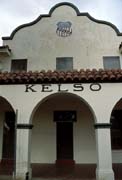
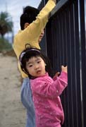
- Kelso Depot
 |
 |
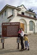 |
Now nearly a ghost town in
the center of Mojave National Preserve, Kelso
was once a thriving railroad and mining
community of 2000 people. Built by the Union
Pacific Railroad in 1924 to serve the steam
locomotives from Los Angles to Salt Lake
City. There is a plan to restore the depot
and makes it the Preserve's new visitor
center. |
- Kelso Dunes
One of the most spectacular and popular sights in the
area, the 600 foot high dunes are surrounded by 45
square miles of sands, and are visible from miles
away.
- Joshua Tree
The weather was changing fast on the way from Mojave
Preserve to Joshua Tree. When we were approaching Joshua
Tree, it was vey windy and the visibility was poor due to
the sand storm. We arrived at Twentynine Palms (a small
town just outside the park) at about 2PM. We checked in
the hotel, and the hotel manager said he has never seen
the weather like this before. We had a suite with 2
bedrooms, 1.5 bathrooms, a kitchen, a TV and a VCR (which
we found very valueable during our stay). It's a nice
home for us for the next 3 days. After we took a short
break, the weather has calmed down quite a bit, and we
headed to the park.
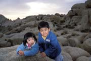
- Split Rock/Skull Rock
 |
 |
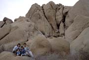 |
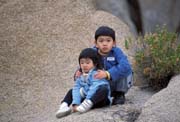
We went to Split Rock area
as our first stop in Joshua Tree. The rock
formations here are interesting and there are
many easy accesses to those rocks. We spent
about an hour around the rocks, and Linus and
Iris had a good time climbing those rocks.
But it was too cloudy and the light was too
flat for any good rock photo opportunities. |
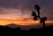
- Sunset
When we drove back, I saw the sky turn red gradually
from my mirror. I could not resist to stop by the
road and walked into a field of Joshua trees. We were
so lucky that the cloud has dispersed and the sun
could peep through cloud now. It turned out that it
was one of most colorful sunset I've ever seen.
It was Thanksgiving night. Instead of having turkey,
we have prepared our own firepot dinner with all good
stuffs we brought from home in igloos.
The Third Day ...
- Fortynine Palms Oasis
This oasis, where water-loving plants thrive and thirsty
animals come to drink, is accessibly by a 1.5-mile
moderately strenuous trail. The trail climbs initially
with a good view of 29 Palms region, and then descends to
a valley where you can see a group of palm trees in the
distance. It's a good feeling to see an oasis with trees
when you hike in the desert. Now it's a piece of cake for
Linus to hike a 3-mile round-trip trail like this one.
- Indian Cove
 |
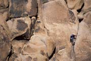 |
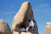
Indian Cove is not only a
favorite camping site, but is also a popular site
for rock-climbing enthusiasts. We had a picnic in
the camp ground area, and saw many rock climbers
on their way to the top of the rocks. |
 |
- Hidden Valley
We drove into the Park from the West Entrance Station.
The altitude is around 3000 feet , and the Joshua trees
grow into what could almost be called a forest. Joshua
trees grow in one stalk for several years, usually until
a flower is produced. After flowering new branches can
take off in any direction. The shapes of Joshua trees are
only limited by your imagination.
We stopped at Hidden Valley and took a 1-mile nature trail
which takes us into a rock-enclosed valley rumored to have
been used by cattle rustlers in the late 1800's. After a few
steps, Iris insisted to walk on her own. Although it is an
easy 1-mile trail for us, it is not so easy for Iris with all
those rocks, stairs, and all kinds of obstacles.
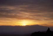
- Sunset at Keys View
| Keys View overlooks an expanse
of valley, mountain, and desert from its
elevation of 5185 feet. On our way to the top of
Keys View, Iris fell asleep in the car already.
Linus and Woanyu went up to the viewpoint, and
Iris and I stayed in the car to take a nap. I
didn't go up until it's close to the time of
sunset. With just right amount of cloud covering
the mountains, it was another colorful sunset
today. |
 |
 |
The Fourth Day ...
- Sunrise at Cap Rock
I went to the Cap Rock and wanted to capture the rocks
bath in the warm morning light. However, the sun only
came out for a few minutes and only lit the distant
mountains, and then hid behind the low cloud for the rest
of the early morning. The Cap Rock didn't even have a
chance to get any sunshine.
- Arch Rock
Arch Rock is located in the White Tank Campground area.
There are many interesting rocks including the formation
of a natural arch. I had to leave my tripod and camera
bag on the trail to climb the rocks beyond the Arch.
Again, Linus and Iris enjoyed wandering among those
rocks.
- Cholla (choy-ya) Cactus Garden
After we crossed the transition zone of Mojave and
Colorado Desert, the views were totally different. The
lower altitude Colorado Desert is drier and more like a
real desert to me. Cholla Cactus Garden has a short
self-guided nature trail, featuring plants and animals
(although we didn't see any) of the Colorado Desert,
winds through this area.
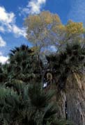
- Cottonwood Spring
 |
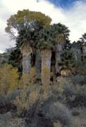 |
We continued to drive south to
the Cottonwood Visitor Center. After a short walk
behind the visitor center, we went on to
Cottonwood Spring and had a picnic in the
campground. After lunch, we began to hike to the
Cottonwood Spring Oasis from the campground.
Cottonwoods were actually planted by the early
settlers who came here because of mining interest
in gold. After the hike (about 1.5-mile
round-trip), we decided to go back to hotel early
because Iris was already tired and fuzzy (and she
fell down on the trail to Cottonwood Spring). We
were lucky that when we got back at about 3:30PM,
the weather began to change rapidly. It was windy
(like the first day we got here) and began to
rain! Yes, we saw the rain in the desert and we
did not have to run for shelter in the field. |
Last Day. Going Home ...
We left at 7:00 in the morning and hoped to beat the holiday
traffic on our way home. The traffic condition was better than we
expected except at a McDonald's along I-5 where we spent more
than 40 minutes in the line to buy food. Linus and Iris both were
very cooperative and didn't complain at all during the entire
9-hour drive. With a little bit traffic near Gilroy (HWY152 to
101), we got home before 4:00PM. Although there was a winter
storm in Bay Area all weekend long, we enjoyed the wonderful
weather in the desert for our Thanksgiving this year.
[Back to Photo Page] [Go to Joshua Tree Gallery]