Lassen Peak, which burst into eruption and began a 7-year
cycle of sporadic volcanic outbursts in 1914, was the most recent
eruption in the contiguous 48 states before the 1980 eruption of
Mount Saint Helens in Washington. The peak is the southernmost
volcano in the Cascade Range, which extends from northern
California into Canada. The area became a national park in 1916
because of its significance as an active volcanic landscape, and
it is still one of the most atcive volcanic area in the US today.
Getting there ...
We began our volcanic journey (Lassen and Crater Lake) in the
early morning. It will be a very long drive if we go to Crater
Lake directly. So we decided to go to Lassen first for 2 days,
then go to Crater Lake for another 3 days, and stay in Redding
for one night on the way home to avoid extreme long distance
driving. We found out that Iris' tolerance in the car is about 3
hours. We had to stop at McDonald's (with playground) to let
Linus and Iris play and relax. We checked in Mineral Lodge (about
8 miles south to Lassen park boundary) at about 2:00PM and we
thought we were probably the only guests for the night. We took a
short break in the room before venturing into the park.
The First Day ...
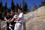
- Sulphur Works
| Sulphur Works is the most
accessible geothermal area in Lassen. There is a
lot of steam and strong smell just right beside
the main road. A short paved trail leads to
Sulphur Works where you can see small mud pots
and steaming fumaroles. |
 |
- Bumpass Hell
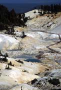 |
Bumpass Hell is the largest
geothermal area in the park. It's about 1.4-mile
one-way easy trail to Bumpass Hell. This is
Lassen's most spectacular and diversified
hydrothermal area, with hot springs, mud pots,
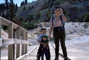
steaming fumaroles, and mud volcanoes. Linus and
Iris were very interested in all the thermal
features, but we have to be careful not to let
them get too excited. |
 |
- Manzanita Lake
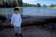
We drove all the way to Manzanita Lake at the other end
of the park (north west). Linus was so tired after hiking
to Bumpass Hell that he fell asleep in the car. It took
me a while to scout around to find a perfect spot for the
mountain reflection in the late afternoon light. Meanwhile Linus and Iris
found a new way to kill time: they picked up and played pine needles and called
them "whiskers".
The Second Day ...
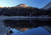
- Sunrise at Lake Helen
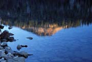
| I went to Lake Helen to wait for
sunrise. The lake is calm and clear, but it does
not have the best angle though. There is a photo
in a book showing the ice formation in Lake Helen
in July! On my way back, I saw a deer just right
beside the road. I stopped the car and we just
looked at each other for at least 10 seconds.
Although I didn't have a chance to get my camera,
I enjoyed the moment of silence. |
 |
 |
- Kings Creek Falls
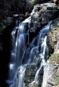 |
 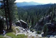 Kings Creek Falls trail is
1.2-mile via foot trail or 1.5-mile via horse
trail to Kings Creek Falls. We chose to take
horse trail descending to the falls, and climbed
back via the foot trail. It was a very correct
choice. The view from the horse trail is the best
in Lassen in my opinion (well, we didn't try the
Lassen Peak trail though). The falls are in shade
for most time of a day; it is only exposed to sun
from late morning to noon. It is important to get
there at the right time if you want to get a nice
picture. The footpath trail along Kings Creek
Cascade is very steep. It's quite difficult and
challenge for Linus. He had to use both hands to
climb rocks. But he enjoyed the challenge and
made it on his own! Kings Creek Falls trail is
1.2-mile via foot trail or 1.5-mile via horse
trail to Kings Creek Falls. We chose to take
horse trail descending to the falls, and climbed
back via the foot trail. It was a very correct
choice. The view from the horse trail is the best
in Lassen in my opinion (well, we didn't try the
Lassen Peak trail though). The falls are in shade
for most time of a day; it is only exposed to sun
from late morning to noon. It is important to get
there at the right time if you want to get a nice
picture. The footpath trail along Kings Creek
Cascade is very steep. It's quite difficult and
challenge for Linus. He had to use both hands to
climb rocks. But he enjoyed the challenge and
made it on his own! |
|
- Summit Lake
Summit Lake area is a very popular campgroud. We had a
relaxed walk along the lake shore.
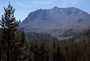
- Devastated Area
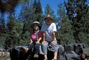
| On May 30, 1914, Lassen Peak
awoke from its long sleep, blasting a 25x40-foot
crater out of its summit. But the worst was yet to
come. On May 22, 1915, Lassen Peak produced its
largest explosion - the 174th recorded. It sent
an ash cloud 30,000 feet into the air, and
blasted superheated air northeast downslope,
totally leveling the forest in an area 1 mile wide
by 3 miles long, creating the "Devastated
Area". Today, the area has been recoverd
gradually, and reforestation is well underway. |
 |
 |
- Moonrise
We found a good turnout, just passed the road's highest
point (8512 feet), which has a nice view facing east. We
went back to the Mineral Lodge early to take a break
because Linus was already tired. We also finished dinner
early and returned to the vista point for sunset and
moonrise.
The Third Day ...
- Sunrise
I went back to the same spot for moonrise on the previous
day to see sunrise.
- Manzanita Lake
 |
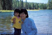 |
It was the last stop in Lassen
National Park for our trip. We went to Loomis
Museum where some photos of
early eruptions were displayed. We had a picnic by Mazanita Lake,
but there were too many bees interested in our
lunch. |
- Subway Cave
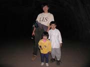
| Subway cave is located in Hat
Creek Valley area (north of Lassen National
Park). The cave, usually at or near 46 degrees F,
extends for about 2300 feet, but only 1300 feet
is open to the public. The ceiling ranges from 6
to 16 feet in height, so we have to be very
careful with Iris sitting on my shoulder. The
floor is not very smooth and we have to watch our
step very carefully. We brought 2 flashlights
with us, and we are in absolute darkness inside
the cave when we turned off the light (there were
many other visitors in the cave, so the moment of
absolute darkness was not very long). After we
emerged from the cave and walked back to the
parking lot, Linus insisted to go again. |
 |
Now it's time to move on to our next destination: Crater Lake.
[Back to Photo Page] [Go to Lassen Gallery]